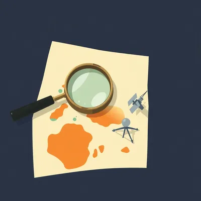
You know, Herman, I was looking out the window this morning at the Jerusalem skyline, just watching the sun hit those limestone buildings, and I had this realization. Every single pixel of a photo taken from our balcony carries a thousand little secrets. It is not just a picture of a city. It is a data point in a global coordinate system that we can no longer hide from. It is February fourteenth, twenty twenty-six, a beautiful Valentine’s Day morning, but all I can think about is how the very light hitting those stones is a timestamped signature of our exact position on the planet.
You're right, Corn, that's a poetic, if slightly paranoid, way to start the day. But you are absolutely right. The world has become a giant jigsaw puzzle, and the pieces are getting smaller and easier for machines to fit together. I am Herman Poppleberry, and today on My Weird Prompts, we are diving into the terrifyingly impressive world of modern geolocation. Our housemate Daniel actually sent us a fascinating prompt about this very thing. He was asking about the evolution of geolocation, specifically in the era of artificial intelligence, and how the "background noise" of our lives has become a forensic map.
And Daniel pointed out something I had never really noticed before, even though I see it all the time in news footage. He mentioned that in some military videos, particularly those coming out of high-conflict zones or sensitive testing sites, you see the clouds and the horizon being blurred out. It sounds like something out of a spy novel, but he wanted to know if you can actually geolocate a photo based on unique cloud formations. That blew my mind. I mean, clouds move. They change every second. How can a vaporous, shifting mass be a fingerprint?
Cloud-based geolocation is very real, and it is incredibly powerful. It is one of those things that sounds like science fiction until you realize the sheer scale of the data we are collecting. It is not that the cloud itself is a permanent landmark like the Eiffel Tower. It is that the cloud is a timestamped landmark. We have to stop thinking of maps as static drawings and start thinking of them as four-dimensional data sets where time is the most important axis.
Okay, so walk me through that. If I take a photo of a cloud over Jerusalem at ten o'clock in the morning, how does that tell anyone where I am?
Think about the weather satellites orbiting the Earth right now. We have geostationary satellites like the Meteosat series, the Goes satellites, and the Himawari-nine. By twenty twenty-six, these systems have reached a level of resolution that is staggering. They are taking high-resolution infrared and visual images of the entire planet's cloud cover every few minutes. If you post a photo with a distinct cloud pattern—say, a specific cluster of cumulus fractus or a unique wave pattern in a cirrus layer—an investigator or an artificial intelligence can cross-reference your photo with the satellite archives for that specific day and hour.
So they are basically playing a giant game of "match the shape"?
They look for the shape, the density, the altitude, and the perspective. Because the satellite is looking down and you are looking up, the artificial intelligence has to perform a geometric transformation to see if the "bottom" of the clouds in your photo matches the "top" of the clouds seen from space. If the pattern in your photo matches the pattern seen from space over a specific coordinate at a specific time, they have got you. It narrows the search area from the entire planet to a few square miles in seconds.
That is terrifying in a very technical way. So when the military blurs the clouds, they are not just hiding the weather or the pretty sunset, they are hiding the "when" and the "where" simultaneously. They are breaking the link between the image and the satellite record.
That's right. It is a defense against what we call Open Source Intelligence, or OSINT. In the old days, you needed a massive intelligence agency with a room full of supercomputers to do this. Now, you just need a subscription to a satellite data feed and a clever Python script. It is about removing any "uniqueness" from the image. If you blur the horizon, you remove the topography, the mountain ranges, the tree lines. If you blur the clouds, you remove the temporal fingerprint. You are essentially trying to turn a specific place into a generic "anywhere."
It feels like we are losing the ability to just "exist" in a space without being indexed. But Daniel also mentioned these new artificial intelligence tools that claim they can locate an image from anywhere on Earth based just on visual clues, without any metadata. We have all seen the people on social media, like that guy Rainbolt, who can find a random patch of grass in five seconds. Is that just human intuition, or is the artificial intelligence actually better at it now?
It is a bit of both, but the artificial intelligence is catching up and, in many ways, surpassing the best humans. Have you heard of the PIGEON model? It stands for Predicting Image Geolocation. It was developed by students at Stanford a couple of years ago, and by now, in twenty twenty-six, the commercial versions of these models are everywhere. They trained a neural network on hundreds of thousands of images from Google Street View, but they did not just teach it to recognize landmarks. They taught it to recognize "vibes," for lack of a better word.
Vibes? Like, "this looks like a Mediterranean vibe"? That sounds a bit unscientific for a neural network.
It sounds that way, but it is actually deep semantic analysis. The artificial intelligence learns to recognize the specific shade of red in the soil, which tells it about the mineral content of the region. It looks at the way the power lines are constructed—are they wooden poles or concrete? Are the insulators ceramic or plastic? It looks at the type of foliage—is that a specific subspecies of eucalyptus that only grows in Western Australia? It even looks at the language on the road signs, the color of the license plates, and the specific font used on public notices.
I remember seeing a demonstration where the artificial intelligence could tell the difference between two very similar-looking rural roads just by the type of gravel used in the shoulder. It is that level of specificity that is changing the game. But what happens when you do not have a road? What if it is just a photo of a forest or a desert?
That is where it gets really impressive. There is a tool called GeoSpy that a lot of people are talking about lately. It uses a combination of visual recognition and topographical mapping. If there is a mountain in the background, the artificial intelligence compares the silhouette of that mountain against a global digital elevation model. It is basically doing a digital "overlay" until the shapes match perfectly. It can account for the lens distortion of your camera and the atmospheric haze. It is like having a person who has memorized the shape of every mountain on Earth.
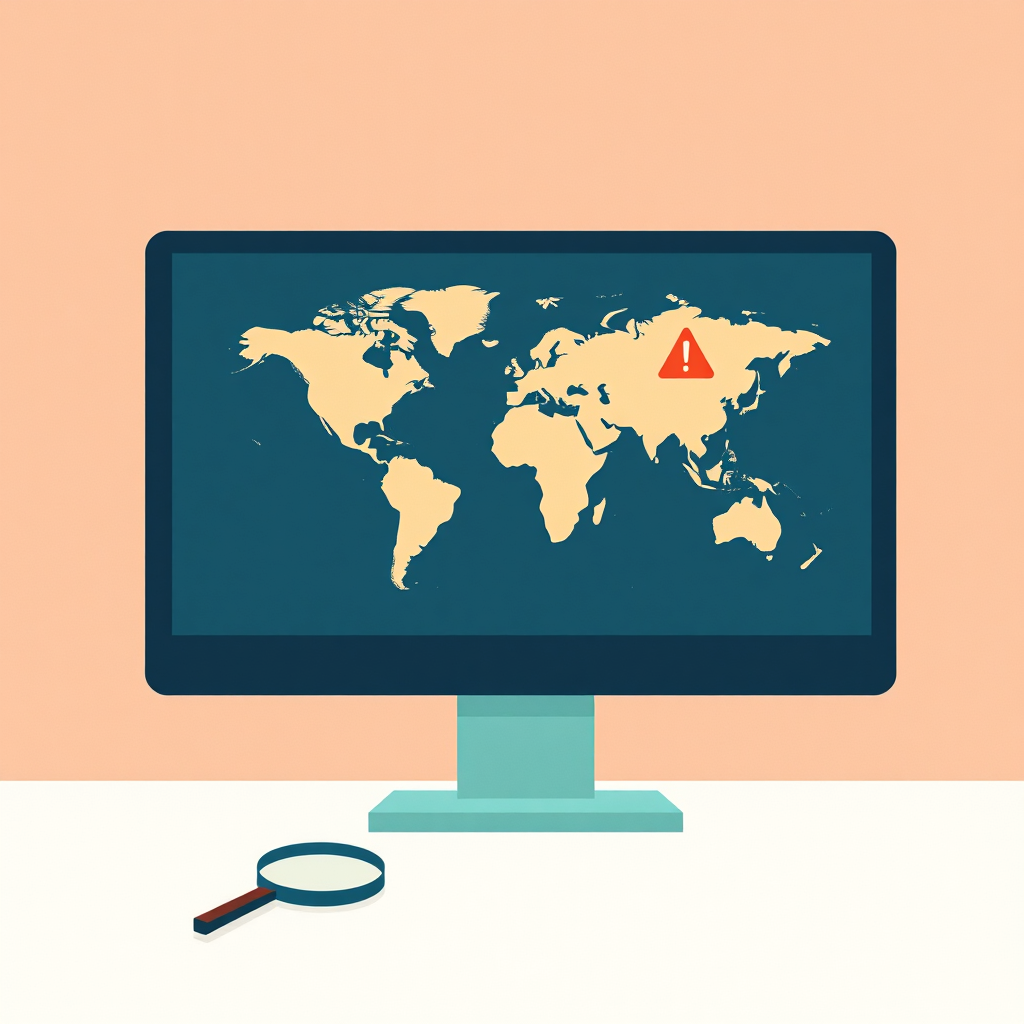
So, essentially, the Earth's surface is its own metadata. We used to rely on EXIF data, you know, the hidden text in a photo file that says "taken at these coordinates." We thought deleting that made us safe. But what you are saying is that the image itself is the coordinate. The pixels are the Global Positioning System.
That is the big shift. We are moving from "metadata-dependent" geolocation to "content-only" geolocation. And for nation-states, this is a massive advantage. They have access to classified, sub-meter resolution satellite imagery that is updated almost constantly. If a nation-state wants to find where a video was filmed, they are not just using the tools available to you and me. They have "all-source" intelligence. They can match the shadows in your photo to the exact minute of the year using chronolocation.
Chronolocation. I love that term. It sounds like something out of a time-travel movie. Explain how that works for the listeners, because that feels like one of those "insider" secrets that people need to understand.
It is actually quite simple in principle, but incredibly difficult in practice without artificial intelligence. Every object on Earth casts a shadow. The length and the angle of that shadow are determined by three things: the height of the object, the time of day, and the geographical location. If I have a photo of you standing next to a lamp post in Jerusalem, and I can see the shadow of that lamp post, I can calculate the sun's position in the sky.
So if you know the date, you can find the place?
Right. If I know the date—say, today, February fourteenth—and I can see the angle of the shadow relative to a known landmark or even just the orientation of the street, I can narrow down your location to a very specific corridor on the Earth's surface. Combine that with the visual clues of the buildings around you, and I can pin you down to the exact street corner. There are tools like SunCalc and ShadowCalculator that OSINT enthusiasts use, but the military versions can do this automatically for every frame of a video.
And if you have artificial intelligence doing that calculation across millions of possibilities in seconds...
Then the haystack disappears and you are just left with the needle. It is why you see people being so careful now. Even a reflection in someone's sunglasses or the reflection in a window can provide enough visual data for an artificial intelligence to reconstruct the environment. There was a famous case a few years ago where a Japanese pop star was geolocated by a stalker who looked at the reflection in her pupils in a high-resolution selfie. He saw the reflection of a train station sign and used that to find where she lived.
That is absolutely chilling. It makes me think about the OSINT community. You mentioned them earlier. These are often just enthusiasts, right? People who do this as a hobby. Daniel mentioned the challenges on social media where people compete to find locations. It is almost like a sport. But it has real-world consequences. We have seen OSINT groups track movements in conflict zones or verify human rights abuses just by looking at the background of a TikTok video.
The power of the crowd is immense. There is a guy named Rainbolt who is famous for his GeoGuessr skills. He can look at a picture of a random dirt road for a tenth of a second and tell you it is in suburban Mongolia. He has trained his brain like a neural network. But when you combine that human intuition with artificial intelligence tools, you get something incredibly potent. The OSINT community uses things like PeakVisor to identify mountain ranges or specialized scripts to scrape historical weather data. They are becoming a decentralized intelligence agency.
But there is a gap, right? I mean, as much as a hobbyist can do with a laptop, a nation-state must be on a completely different level. What does the "pro" version of this look like in twenty twenty-six?
The pro version involves things like Synthetic Aperture Radar, or SAR. Unlike traditional cameras, SAR does not need light. It uses microwave pulses to map the Earth. It can see through clouds, smoke, and total darkness. Nation-states have constellations of these satellites, like the ones operated by Capella Space or Iceye. So, if you are a military group and you think you are safe because it is a cloudy day and you have blurred the horizon, you might be wrong. The SAR satellites are mapping the ground beneath you with centimeter-level precision.
So they are not even looking at your video at that point?
They are using the video as a "key" to unlock other data. They can detect changes in the soil where a vehicle has driven or where a structure has been moved. They integrate this with signal intelligence, like tracking the unique radio frequency signatures of your equipment or even the "electronic noise" emitted by a modern camera. The video is just one layer of what I call the "data sandwich." For a nation-state, the visual geolocation is often just a confirmation of what their other sensors are already telling them.
This brings up a big privacy question. If an ordinary photograph contains this much information, is there any way to actually protect yourself? Or are we just living in a world where "private location" is an oxymoron?
It is becoming very difficult. You can strip the metadata, which you should still do, because it is the low-hanging fruit. But to truly hide, you have to be conscious of the environment. You have to avoid "unique" landmarks. You have to be careful with shadows. You have to make sure there are no reflective surfaces. In a way, we are all having to learn the tradecraft of spies just to maintain a basic level of privacy.
It is funny you say that. I remember reading about how some high-profile individuals now have "neutral" rooms in their houses specifically for taking photos or doing video calls. Just plain white walls, no windows, no distinctive molding on the baseboards. It is a "non-place."
A non-place. That's a great term for it. It is the only way to defeat a global artificial intelligence that has memorized the texture of every sidewalk on the planet. But even then, if your phone is in your pocket, the accelerometer and the barometer are recording data. The barometer can tell your altitude based on air pressure. If you are on the fortieth floor of a building in New York, the air pressure is different than if you are on the ground floor. An artificial intelligence can match that pressure reading to local weather station data to figure out exactly which floor you are on. We are surrounded by "witnesses."
Let's go back to the "ordinary" photo for a second. Let's say I take a picture of a flower in a park. No buildings, no mountains, no clouds. Just a flower and some grass. Can an artificial intelligence find that?
Surprisingly, yes. It is called "biogeography." Different species of plants grow in very specific soil types and climates. If that flower is a specific subspecies that only grows in a certain part of the Judean Hills, and the soil color matches the iron-rich terra rossa of this region, the artificial intelligence can narrow it down to a few square miles. If there is a specific type of insect in the frame, that is another data point. If there is audio in the background, the artificial intelligence can analyze the "soundscape"—the specific frequency of the wind through the trees or the distant hum of a specific type of electrical transformer. It is all about the "intersection of probabilities."
The intersection of probabilities. That's the key phrase right there. It is not that one thing gives you away; it is that ten small things, when combined, can only exist in one place on Earth.
That's it. And artificial intelligence is the perfect tool for finding that intersection. Humans are good at seeing the "big" things, like the Eiffel Tower. Artificial intelligence is good at seeing the ten thousand "small" things that we do not even register as information. It is looking at the "semantic segmentation" of the image—breaking it down into categories like "asphalt," "limestone," "pine needle," and "power line"—and then searching a global database for where those things coexist.
It is a bit overwhelming, to be honest. But I think it is important for people to understand that this isn't just about "big brother" or the government watching you. This technology is being democratized. The same tools that a human rights group uses to find a hidden prison in a remote desert are the same tools that a stalker could use, or a private investigator, or even just a curious neighbor.
That is the double-edged sword of the era we are in. Transparency is great when it holds power to account. We have seen OSINT researchers use these techniques to prove that certain munitions were used in civilian areas by matching the crater patterns to satellite imagery. But it is devastating when it erodes the "right to be forgotten" or the right to be anonymous. We are living in a global panopticon, but the walls are made of our own data.
I want to pivot a little bit to the practical side. If someone is listening to this and they are starting to feel a little paranoid—maybe they are a journalist or just someone who values their privacy—what are the actual takeaways? Besides building a white-walled "non-place" in their house.
Well, first, do not let it stop you from living your life. But do be mindful. If you are posting something that you want to keep private, think about what is in the background. Is there a street sign? A unique tree? A reflection in a window? Use the "blur" tools that are available, but know that they aren't foolproof. By twenty twenty-six, we have artificial intelligence models that can actually "de-blur" certain types of pixelation if they have enough context. They use generative adversarial networks to "hallucinate" the most likely original image.
Wait, really? They can reverse a blur? That sounds like the "enhance" button from bad eighties movies.
It is exactly that, but it actually works now. If it is a simple Gaussian blur, the artificial intelligence can sometimes "guess" the original pixels based on the surrounding data and its knowledge of what "typical" objects look like. It is much better to "black out" or "crop out" sensitive information rather than just blurring it. And of course, be aware of the "temporal" clues. If you post a photo of a beautiful sunset with a very specific cloud formation, you have just given away your longitude and the exact time you were there. Maybe wait a few days to post it, or don't mention the date.
That's a good tip: "post-dating" your life to break the temporal link. It is like a digital version of "leaving a cold trail."
Right. And honestly, just being aware that this is possible is half the battle. Most people still think of photos as just "images." They don't see them as "coordinate sets." Once you start seeing the world through the lens of geolocation, you become much more intentional about what you share. You start to notice the "leaky" parts of your environment—the reflection in your coffee cup, the specific way the shadows fall across your desk, the type of bird singing outside your window.
It is a fascinating evolution. We went from maps being precious, secret documents held by kings and explorers, to everyone having a perfect map in their pocket, to the entire world becoming the map itself. It is like that short story by Jorge Luis Borges, where they build a map so detailed it is the same size as the empire.
It is the ultimate "one-to-one" map. We have finally built it, and it is made of pixels, radio waves, and artificial intelligence weights. We are all living inside the map now.
You know, we have covered a lot of ground today, from clouds to shadows to the flora of the Judean Hills. It really shows how interdisciplinary this field has become. It is not just computer science; it is geography, meteorology, biology, and physics all wrapped into one. It makes me wonder what the next "witness" will be. Maybe the way the air vibrates?
Actually, that is already happening. There is research into "visual microphones," where artificial intelligence can look at the tiny vibrations of a potato chip bag or a plant leaf in a silent video and reconstruct the audio of the room. Every object is a sensor if you have a powerful enough computer to read it.
Okay, now you are just trying to make me never leave my "non-place" room. But that is why we do this show—to look at the weird ways technology is reshaping our reality. Before we wrap up, I want to say that if you are enjoying these deep dives into the weird and wonderful world of technology and human behavior, we would really appreciate it if you could leave us a review on your favorite podcast app. It genuinely helps other curious minds find the show.
It really does. And a big thanks to Daniel for sending in this prompt. It is always fun to dig into the things that are happening right in our own neighborhood and around the world. It reminds us that even a simple photo of a cloud is part of a much larger story.
You can find all of our past episodes, all six hundred and seventeen of them now, at myweirdprompts.com. We have also got an RSS feed there if you want to subscribe directly and avoid the algorithms for a bit.
And if you have your own "weird prompt" or a question about the technology shaping our world, head over to the website and use the contact form. We love hearing from you, whether it is about artificial intelligence, space, or the secret life of clouds.
This has been My Weird Prompts. I am Corn.
And I am Herman Poppleberry.
Thanks for listening, and we will catch you in the next one.
Goodbye, everyone. Stay safe out there in the map.

")