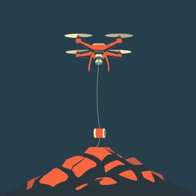
Here's what Daniel sent us — Israel announced yesterday they captured Beaufort Castle in southern Lebanon. It's a Crusader-era fortress that's been fought over for nine centuries, and the IDF just raised a flag on it again. His question is basically this: in an age of drones, satellites, and precision-guided munitions, why does holding a hilltop still matter enough to justify a ground assault? What are the actual tactical advantages that make elevated terrain so persistently valuable?

This is one of those questions where the answer seems obvious until you actually try to explain it, and then you realize how much physics is hiding underneath the cliché. The short version is that high ground matters more now than it did fifty years ago — but for different reasons. The value has shifted from physical defense to what I'd call information dominance. Let's start with the thing nobody can cheat: the sensor horizon.
Geometry doesn't negotiate.
It really doesn't. So here's the formula that explains half of modern warfare — the distance to the radar horizon in kilometers equals four point one two times the square root of the antenna height in meters. That's it. That's the whole thing. If you're standing on flat ground with your eyes two meters up, you can see about five point eight kilometers before the curvature of the earth blocks your view. Put a radar or an electro-optical sensor at Beaufort Castle, six hundred and fifty meters up, and suddenly your horizon is a hundred and five kilometers.
From one hilltop, you're seeing the equivalent of... what, an eighteen-fold increase in reach?
And this isn't a software problem. You can't algorithm your way past the curvature of the earth. You can't train a neural network to see through rock. It's geometry. The only way to extend your sensor horizon from a valley floor is to elevate the sensor — which means either putting it on an aircraft, a satellite, or a hill. Aircraft have to refuel. Satellites have revisit times measured in hours, not minutes. The hill stays there.
That's the thing about the persistence argument. A drone gives you maybe thirty minutes of loiter time for a small quadcopter. A soldier with binoculars on a ridge gives you continuous observation for as long as you hold the position. There's no battery to drain, no datalink to jam.
Right — and let's talk about the jamming angle, because this is where the electronic warfare dimension gets interesting. If you're trying to jam enemy communications from a valley, your signal has to punch through terrain, foliage, buildings. Put that same jammer on a hilltop with the same power output, and suddenly you've got clear line of sight to every receiver within a hundred kilometers. You're suppressing communications across an area that would take ten valley-floor jammers to cover. The hilltop is a force multiplier for electronic warfare in a way that's almost unfair.
Like putting your Wi-Fi router on the roof instead of in the basement.
That's actually a perfect analogy. And the same logic applies to signals intelligence — if you're trying to intercept enemy radio traffic, being on a hilltop means you can hear transmissions from far beyond what a ground-level listening post could pick up. The IDF explicitly noted that from Beaufort, you can see deep into the Galilee Panhandle and the Nabatieh area. That's not just visual observation — that's SIGINT coverage. You're listening to Hezbollah's communications across southern Lebanon from one position.
This is where the Wi-Fi router analogy actually understates things. A router in your basement still works, just badly. A signals intelligence team in a valley might get nothing at all — not degraded reception, but zero. Because if there's a ridge between you and the transmitter, the signal simply doesn't arrive. Radio waves at the frequencies used for tactical communications don't diffract over hills the way AM radio does. They're line-of-sight or they're nothing.
That's an important distinction. People assume radio is radio — it goes through walls, it goes around corners. That's true for some frequencies, but the VHF and UHF bands that militaries use for tactical communications are essentially line-of-sight. If you can't see the transmitter, you probably can't hear it either. So the hilltop doesn't just improve your SIGINT — it makes it possible in the first place.
Let's put some numbers on this. The research I saw cited a US Army field test from 2023 at Fort Sill — counter-battery radar detection range increased by about forty percent when they elevated the radar from a hundred meters to six hundred meters. That's not incremental. That's the difference between catching a mortar team and missing them entirely.
Counter-battery radar is one of those things that sounds boring until you realize it's the reason artillery duels don't last all day anymore. The moment you fire, a radar system triangulates the trajectory, computes the launch point, and within seconds — sometimes under a minute — counter-battery fire is on its way back to your position. If the defending radar is on a hilltop, it's seeing launches from farther away and with better accuracy because it has a clearer angle on the projectile's ascent phase. The radar at six hundred meters can detect a mortar launch that a radar at a hundred meters literally cannot see because the terrain is in the way.
Let's unpack why that forty percent number matters in practical terms. A typical mortar team can set up, fire a few rounds, and pack up in under three minutes. If your counter-battery radar detects the launch at forty seconds, you've got about two minutes to get rounds back on target before they're gone. If terrain obstruction delays your detection by even thirty seconds, that window collapses. You miss them. The elevation of your radar isn't just about range — it's about reaction time. And in counter-battery warfare, reaction time is everything.
And it connects to something I want to flag about the Fort Sill test that doesn't get enough attention. The forty percent improvement wasn't just about seeing farther — it was about seeing sooner. At higher elevation, the radar catches the projectile earlier in its ascent, when it's still climbing and before it's masked by terrain features. That earlier detection translates directly into faster response. You're not just expanding the radius of your coverage — you're compressing the timeline from detection to engagement.
Which brings us to Beaufort specifically. Six hundred and fifty meters above sea level, overlooking the Litani River valley. From that position, you can monitor every crossing point along the river. Hezbollah used exactly those crossing points in 2006 to move anti-tank teams into position. The Times of Israel report noted that the Beaufort Ridge and Wadi Saluki area contained what they called significant Hezbollah infrastructure established with Iranian assistance — command posts, observation posts, the works.
The 2006 precedent is instructive here. Hezbollah used Beaufort Castle as an observation post for Kornet anti-tank missile teams. From that elevation, they had clear line of sight to Israeli armor moving in the valley below. Five Merkava tanks were destroyed from that position. That's not ancient history — that's the same weapons system Hezbollah still uses, and the same terrain, and the same tactical logic. The IDF didn't seize Beaufort because it's a nice place for a photo op. They seized it because whoever holds that ridge controls what moves in the valley beneath it.
Here's the thing about the Kornet specifically — it's a laser-beam-riding missile with an effective range of about five and a half kilometers. But that's the horizontal range. From an elevated position, the missile is firing downward, which means gravity is working with the motor, not against it. The effective range stretches. A Kornet team on Beaufort isn't just harder to spot — their weapon actually performs better than the same missile fired from the valley floor.
It's not unique to the Kornet. Almost every direct-fire weapon benefits from elevation because the projectile is traveling through thinner air and has a gravity assist. A tank round fired downhill loses less velocity to air resistance and drops less over distance. The gunner's aiming solution is simpler. Even a rifleman benefits — the bullet's trajectory is flatter, so range estimation errors are more forgiving. The hilltop is a ballistic advantage for everything from a sniper rifle to an anti-tank missile.
We've established that the physics of sensor horizons hasn't changed since radar was invented. But what about the weapons themselves? Let's talk about how elevation affects the trajectory of a mortar round — and why that matters more than you might think.
This is where the ballistic advantage gets counterintuitive. Most people assume elevation just means your shells go farther. That's true, but it's not the interesting part. The interesting part is what happens to your minimum range. A mortar in a valley has a minimum engagement distance because the round has to clear the terrain around the launch site — it needs a certain arc to get over the hills or buildings in front of you. Put that same mortar on a hilltop, and your minimum range shrinks dramatically because the round is already above everything. You can drop shells almost straight down onto targets that are physically close to your position.
You're saying the hilltop gives you both a longer maximum range and a shorter minimum range. You're expanding the engagement envelope in both directions.
And for howitzers, the effect is even more pronounced. A howitzer at six hundred and fifty meters elevation firing at a target in the valley can use a shallower trajectory, which means the shell arrives faster and is harder for counter-battery radar to track because it's not following the high arc that radars are optimized to detect. You're making your fire both more effective and harder to respond to.
I want to pause on that minimum range point because it's one of those things that sounds like a niche technical detail but actually has huge tactical implications. Imagine you're a mortar team on a hilltop and an enemy unit is trying to assault your position. If you're in a valley, there's a donut-shaped dead zone around you where the mortars can't hit because the rounds would have to come down too steeply. That dead zone is exactly where an assaulting force wants to be. On a hilltop, that dead zone shrinks or disappears entirely. You can engage targets right up to the base of your position.
That changes the assault calculus for the enemy. If they know your mortars can't hit within three hundred meters of your position, they'll try to close that distance as fast as possible. If they know you can drop rounds on your own perimeter, that changes their approach entirely. They have to suppress your mortars before they can close. The hilltop mortar team forces a completely different tactical problem on the attacker.
That's the offensive side. But there's a defensive paradox here: if hilltops are so valuable, why aren't they death traps? The answer lies in how modern militaries occupy them — and how quickly they leave.
This is the misconception I want to really dig into. The image people have is of a fortress on a hill — static, obvious, vulnerable to precision strikes. And that was true in 1982 when the IDF first took Beaufort and then sat on it for eighteen years. But modern doctrine has evolved. The hilltop is now an observation post, not a bunker. You occupy it, you observe, you direct fires, and then you vacate before counter-battery fire arrives. The IDF at Beaufort used the reverse slope — advancing under the crest line so they were invisible to direct fire from below, then occupying the observation positions on the crest only long enough to do the job.
The reverse slope defense is one of those concepts that sounds like ancient history until you realize it still works against thermal optics. If you're on the back side of a ridge, the enemy can't see you with thermals because the ridge itself is blocking the line of sight. You're hidden from direct fire, but you can pop up to the crest, observe, engage, and drop back down.
Modern thermal optics have made this harder — they can detect heat signatures through some foliage, they can see at night — but they still can't see through solid rock. The physics of line of sight hasn't changed. A ridge is still a ridge. The IDF's Golani Brigade Reconnaissance Unit used exactly this tactic in the Beaufort operation — they crossed the Litani River at the ninety-degree bend near Metula, advanced under the crest line, and seized the observation positions without exposing themselves to direct fire from Hezbollah positions in the valley.
There's a nuance here worth exploring. When you say "pop up to the crest," what does that actually look like in practice? Because it's not like a soldier stands up on the skyline and silhouettes themselves. Modern reverse-slope tactics involve crawling to the crest, using a periscope or a remote sensor head that's the only thing breaking the ridgeline, observing for a set period, and then withdrawing. The exposure is measured in seconds, and the exposed profile is tiny.
This is where technology has actually made the reverse slope more viable, not less. Thirty years ago, you needed a human eyeball at the crest. Now you can leave a small electro-optical sensor head on a tripod at the crest and run a cable back to your position on the reverse slope. You're observing the valley from complete defilade. The sensor head is the size of a coffee can. Even if the enemy knows you're somewhere on that ridge, finding and hitting a coffee can with indirect fire is extraordinarily difficult.
Let's talk about the GPS-denied environment, because this is where the hilltop advantage gets amplified rather than diminished. In Ukraine since 2022, and in Israeli operations in southern Lebanon since October 2023, GPS jamming has been routine. Precision munitions that rely on GPS guidance become much less precise — sometimes useless. When GPS is jammed, you fall back to inertial navigation and terrain-reference navigation.
This is where elevation becomes critical for your own systems, not just for denying the enemy's. Inertial navigation systems drift over time — they accumulate error. To correct that drift, you need visual reference points. A position on elevated terrain gives you clear sightlines to multiple known landmarks that you can use to recalibrate your INS. A unit in a valley might only see the ridge in front of them. A unit on the ridge sees everything. The hilltop literally makes your navigation systems more accurate.
The hilltop is improving your sensors, your jammers, your artillery, and your navigation. It's a force multiplier across four different domains simultaneously. That's why you commit ground troops to take it.
There's one more domain — communications relay. In mountainous terrain like southern Lebanon, valley floors are full of dead zones. Radio signals can't punch through ridgelines. A platoon in a wadi might lose contact with battalion headquarters because there's a hill between them. But put a relay on that hilltop, and suddenly everyone's connected. The hilltop becomes the nervous system of the battle space. During the 2024 Battle of Vovchansk in Ukraine, Russian forces held a local water tower hill and used it as a drone relay point. The Ukrainians had to assault that position three times to dislodge it — not because the hill itself was strategically important, but because it was the only place from which the Russians could maintain drone control links across the entire sector.
That Vovchansk example is worth sitting with for a moment. It wasn't a mountain. It was a water tower on a low rise — maybe thirty meters of elevation above the surrounding terrain. And that thirty meters was enough to make it the single most contested piece of ground in that sector. Because without it, the Russians couldn't fly their reconnaissance drones beyond visual line of sight. With it, they could see everything the Ukrainians were doing for kilometers in every direction.
That's the thing that's hard to communicate to people who haven't spent time thinking about military terrain. It's not always the highest mountain that matters. It's the terrain feature that dominates the specific piece of ground you're fighting over. Sometimes that's a six-hundred-meter castle. Sometimes it's a water tower. The principle is the same — elevation relative to the surrounding area is what counts, not absolute height above sea level.
That's the shift I think most people miss. The hilltop isn't valuable because it's hard to attack — it's valuable because of what you can see and what you can communicate from it. It's a server rack, not a castle wall.
That's the perfect way to put it. The value has migrated from physical defense to information dominance. In 1982, the IDF held Beaufort because it was a fortified position that was hard to dislodge. In 2026, they seized it because it's the best sensor platform and communications node in southern Lebanon. The castle walls are almost irrelevant — it's the elevation that matters.
Let's zoom out from the physics and look at the operational level. What does this mean for how we should read conflict reports going forward?
I think the first thing is: when you see a military objective announced, look at the elevation map before you look at anything else. The first objective in any offensive is almost always the highest terrain within ten kilometers of the front line. That's not a coincidence. It's a pattern. If you don't understand the terrain, you don't understand the battle.
The second thing is to ask the right question. When a military takes a hill, the question isn't "why did they want that hill?" — the question is "what sensor coverage did they gain?" The answer to that question explains the casualty tolerance. If taking that ridge gives you observation of enemy supply routes for thirty kilometers, that's worth losing soldiers over. If it doesn't, it's not.
This connects to something that's been true since Sun Tzu but is still underappreciated: warfare is fundamentally about information. The side that sees more, communicates faster, and understands the battle space better wins. High ground is an information advantage before it's anything else. The fact that it also gives you a ballistic advantage and a defensive advantage is almost secondary.
This is where I think the public discourse around military operations consistently misses the point. When a hill is captured, the coverage focuses on the flag-raising, the symbolism, the body count. Nobody runs the radar horizon calculation. Nobody asks what sensor coverage changed hands. But that's the actual story. Everything else is theater.
Theater matters, by the way. We shouldn't dismiss the symbolic dimension entirely. But you're right that it shouldn't be the lead. The lead should be: what can they see now that they couldn't see yesterday?
Let's address the counterarguments, because there are real ones. The first is that drones and satellites should make ground-based observation obsolete. You don't need a soldier on a hilltop if you've got a drone swarm overhead.
The response is persistence and resilience. A small quadcopter drone has maybe thirty minutes of endurance. A medium-altitude drone like a Hermes 450 can stay up for seventeen hours — but it's vulnerable to air defense, it's expensive, and you can't keep it on station indefinitely. A satellite passes overhead for a few minutes every few hours. A soldier on a hilltop with a thermal scope is there continuously, can't be jammed, can't be shot down by a MANPADS, and costs essentially nothing to keep in position once you've secured it. These aren't competing capabilities — they're complementary layers. The drone gives you mobility and reach. The hilltop gives you persistence and resilience.
The cost differential here is staggering when you actually run the numbers. A Hermes 450 costs about two million dollars per airframe, plus operating costs, plus the risk of losing it to air defense. A satellite pass from a commercial provider might cost thousands of dollars per image. A soldier on a hilltop with a pair of binoculars costs... the soldier's salary. And the soldier doesn't have a flight schedule. The soldier doesn't get recalled for maintenance. The soldier is just there.
There's a qualitative difference in the intelligence product too. A satellite image tells you what was there at the moment the shutter clicked. A drone feed tells you what's happening right now, for as long as the drone is overhead. A human observer on a hilltop tells you what's been happening for the last twelve hours — the patterns, the rhythms, the things that only become visible over time. Which trucks come and go. When the guards change shifts. Where the leadership vehicles are parked. That kind of pattern-of-life intelligence is incredibly valuable and very hard to get from a snapshot.
The second counterargument: precision-guided munitions make fixed positions on hilltops death traps. If they know where you are, they can drop a JDAM on your head.
This is where the GPS jamming reality bites. In a contested electromagnetic environment — which southern Lebanon absolutely is — GPS-guided bombs are degraded. The alternatives are laser-guided bombs, which require line of sight from the designator to the target. But if you're the defender on the hilltop, you control the line of sight. The designator has to expose itself to designate you, and you're above it, looking down. That's a losing proposition for the designator. The third option is inertial guidance, which is less accurate. You can still hit a hilltop, but you might not hit the specific observation post. And as I mentioned earlier, modern doctrine has the observation post vacating after a few hours anyway.
The PBS report noted something interesting — Hezbollah has been using hard-to-detect fiber optic drones that the IDF is struggling to respond to. These are drones controlled via fiber optic cable rather than radio, so they can't be jammed. But even those have limitations — the cable has a maximum length, the drone has to fly a predictable path, and it still has to get a visual on the target. A hilltop observer sees the drone coming from kilometers away.
This is where the layered defense concept comes in. The hilltop observer spots the drone. The electronic warfare team jams everything else in the sky. The counter-drone systems engage what gets through. The hilltop is the first layer of that defense — the eyes that make everything else work. Without it, you're reacting to drones that are already on top of you.
There's a historical irony here that I can't get past. Beaufort Castle was built by Crusaders in the twelfth century. Saladin's army held it. The Mamluks held it. The Ottomans held it. The French mandate, the PLO, Israel in 1982 — and now Israel again in 2026. Nine hundred years of military continuity, and the same hill is still the prize. The weapons have changed from trebuchets to fiber optic drones, but the terrain hasn't.
That's the thing about certain terrain features — they're persistently valuable across radically different eras of military technology because they control the same fundamental things: observation, communication, and movement. The Litani River valley hasn't moved. The crossing points are in the same places. The ridgeline still overlooks the same approaches. The Crusaders didn't have counter-battery radar, but they understood that whoever controlled that hill controlled the valley. The physics hasn't changed. Only the tools have.
I want to dwell on that Crusader connection for a moment because it's not just a colorful historical footnote. The Crusaders chose that specific hill for the same reason the IDF wants it now. They were looking at the same river valley, the same crossing points, the same approaches from the north and south. The tactical problem they were solving was identical. The only difference is that they expressed the solution in stone walls and the IDF expresses it in sensor packages and electronic warfare suites.
The Crusaders would have understood the modern use of that hill perfectly. If you told a twelfth-century military engineer that in nine hundred years, soldiers would still be fighting over Beaufort because it lets you see a hundred kilometers in every direction, he wouldn't be surprised. He'd say, "Yes, that's why I built the castle there.
The BBC report mentioned that this is the deepest Israeli incursion into Lebanon in more than a quarter century — troops are now about five kilometers from Nabatieh, which is a major southern Lebanese city. And this happened despite a nominal ceasefire that's been in place since April 17.
The PBS piece quoted a Beirut analyst, Joe Macaron, who made a point that I think is worth highlighting. He said that the more land Israel can grab before a ceasefire solidifies, the more conditions they can impose on Hezbollah before any withdrawal. The high ground isn't just a tactical asset here — it's a bargaining chip. You seize the ridge, you control the observation, and then you say: we'll leave when certain conditions are met. The hilltop becomes diplomatic leverage.
Which is a very old playbook, by the way. Take the high ground, negotiate from strength. That's been the move since before there were diplomats.
The symbolic dimension matters too. Defense Minister Katz explicitly tied the flag-raising to protecting the Galilee towns below. The castle overlooks the Galilee Panhandle. For Israelis who remember the 2006 war — when Hezbollah fired thousands of rockets into northern Israel — the idea that the same position used to direct those attacks is now under IDF control has real psychological weight. It's not just about military utility. It's about signaling.
The UNESCO angle is also worth noting. Beaufort Castle was given enhanced protection status in 2024 as a cultural heritage site. The flag-raising at a protected site creates genuine tension between military necessity and cultural preservation obligations. The French, British, and German foreign ministers have already condemned the escalation — the French foreign minister called it unacceptable and requested an emergency UN Security Council meeting.
This is one of those recurring tensions in modern warfare. Cultural sites get caught in the crossfire because they're often built in strategically significant locations — which is exactly why they were built there in the first place. The Crusaders didn't pick that hilltop because it was pretty. They picked it because it commanded the valley. The cultural value came later. The military value was there from day one.
This creates an almost impossible tension in the laws of armed conflict. The 1954 Hague Convention protects cultural property during hostilities, but it also includes a waiver for imperative military necessity. So you've got a UNESCO-protected site that is also, by the iron logic of geography, a critical military asset. The law says you can't use it for military purposes unless you really need to. And the military says: we really need to. That tension doesn't resolve cleanly.
It never does. And the history of Beaufort illustrates this perfectly. It's been a military position for nine centuries. The UNESCO designation didn't change the terrain. It just added a layer of legal and diplomatic complexity on top of the same old tactical calculus. The hill doesn't care about UNESCO.
Let me try to synthesize this into something actionable for someone trying to understand conflicts. When you read about a hill being taken, the framework to apply is three questions. First: what sensor horizon did they gain? Calculate the distance — the formula is four point one two times the square root of the elevation in meters. Second: what does that new horizon let them see that they couldn't see before? Rocket launch sites? Third: what electronic warfare advantage does the elevation provide? Better jamming coverage? Better signals intelligence? Better communications relay?
I'd add a fourth question: what does the other side lose by not having that hilltop anymore? In Beaufort's case, Hezbollah loses observation of the Galilee Panhandle, loses a command post for directing attacks, loses a communications relay for their network in southern Lebanon, and loses the ability to use the Litani crossing points without being observed. That's a catastrophic degradation of their operational capability in the region. The hilltop isn't just valuable for what it gives you — it's valuable for what it denies the enemy.
That's the zero-sum nature of high ground. If I have it, you don't. And if you don't have it, everything you try to do in the valley is happening under my observation.
Which brings us to the open question I think is most interesting. We're in an era of proliferating drone swarms and expanding satellite constellations. The number of commercial imaging satellites has exploded — companies like Maxar and Planet Labs are putting up constellations that can image any point on earth multiple times per day. At some point, does the sensor horizon advantage of elevation get negated by persistent overhead coverage?
My instinct is that it doesn't — but the reason it doesn't shifts. If the sky is full of sensors, then the advantage of the hilltop becomes about electronic warfare rather than observation. The hilltop becomes the place from which you jam, spoof, and degrade all those overhead sensors. The high ground becomes the counter-sensor platform.
I think that's exactly right. And there's a knock-on effect here. As drone swarms become more capable, the counter-drone systems become more important. Those counter-drone systems — directed energy weapons, jammers, kinetic interceptors — all benefit from elevation for the same reasons we've been discussing. The hilltop becomes the ideal platform for defending against the very technology that was supposed to make hilltops obsolete.
There's an elegant symmetry to that. The drone was supposed to end the era of the hilltop fortress. Instead, the hilltop becomes the best place to kill drones. The thesis generates its own antithesis, and the synthesis is... still a guy on a hill. Just with different equipment.
That pattern recurs throughout military history. Every new technology that's supposed to make terrain irrelevant ends up being absorbed into the terrain's logic. The machine gun was supposed to make cavalry obsolete, and it did — but it also made the reverse slope defense more lethal. The satellite was supposed to make ground-based observation posts redundant, and instead it made the electronic warfare dimension of those posts more important. The technology changes the tools, but the terrain keeps dictating.
The hilltop isn't becoming less relevant. It's becoming relevant in a different way. The castle wall becomes a server rack. The archer becomes a signals intelligence operator. The moat becomes an electronic warfare perimeter. But the hill is still the hill.
That's the through-line across nine hundred years of fighting over the same piece of rock. The Crusaders didn't know about radar horizons or GPS jamming or fiber optic drones. But they understood — in their bones, in a way that required no math — that being above your enemy is better than being below them. Everything we've added since then has just given us more precise language for describing why that intuition was correct.
For the listener trying to make sense of headlines about hilltop captures and ridge-line assaults, the takeaway is this: technology hasn't made high ground obsolete. It's changed what the high ground is for. It used to be for walls and archers. Now it's for sensors and jammers. But the geometry hasn't budged. The earth still curves. Radios still need line of sight. And the side that's higher up still sees farther, shoots farther, and communicates better than the side in the valley.
One last thing on the specific geography of Beaufort. The castle is about fourteen and a half kilometers from the Israeli border. From that position at six hundred and fifty meters, the radar horizon is about a hundred and five kilometers. That means an observer on that ridge can see not just into northern Israel — they can see almost to Haifa. They can monitor Israeli Air Force operations at Ramat David airbase. They can track naval movement off the coast. The sensor coverage from that single position is extraordinary. Denying that to Hezbollah isn't a tactical nicety — it's a strategic imperative.
That's why the IDF committed ground troops rather than just bombing it from the air. You can destroy a building with a bomb. You can't destroy elevation. The hill is still there. If you want to control what that hill sees, you have to put boots on it.
There's a phrase that gets used in military theory — "terrain dictates." It means the physical landscape imposes constraints and opportunities that no amount of technology can ignore. Beaufort Castle is terrain dictating. It dictated to the Crusaders. It dictated to Saladin. It's dictating now. And nine hundred years from now, whoever is fighting over that ridge — with whatever weapons they're using — will still be dealing with the same geometry.
Now: Hilbert's daily fun fact.
Hilbert: In the early medieval period, a species of ant native to the Sahel region of what is now Niger developed a pheromone so persistent that foraging trails remained detectable by other colonies for weeks after the original colony had been wiped out by drought. When a new colony rediscovered the ghost trails, they followed them to food caches left by the extinct colony, effectively inheriting another civilization's supply lines. Entomologists call this phenomenon necrophoretic foraging.
...right.
This has been My Weird Prompts. Our producer is Hilbert Flumingtop. If you found this useful, leave us a review wherever you listen — it genuinely helps other people find the show. For Corn and Herman, I'm Corn. We'll be back next week.

")