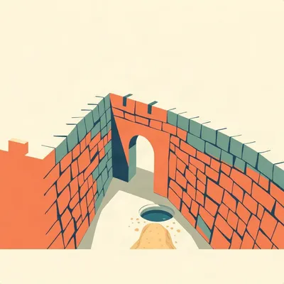
Nineteen years of barbed wire, and the thing that actually took it down was a bulldozer with a municipal parking permit.

That's the story nobody tells.
Here's what Daniel wrote in this week. We all know the shape of it. Jerusalem was a divided city from 1948 to 1967. Barbed wire, walls, military positions, minefields, no-man's-land. Then the Six-Day War ends, and within about a week everyone is saying "unified Jerusalem." Daniel wants to know what physically happened to the border. Who actually removed the barriers? How were the minefields found and cleared? What happened to the kilometres of wire and concrete and ruined buildings? Were bulldozers, army engineers and municipal workers involved, and how big was the operation? Then he wants the street level. Which roads that just stopped dead at the border were reconnected first, and when could a civilian actually walk or drive across? What happened at Mandelbaum Gate, at Musrara, outside the Old City walls, at Abu Tor? And he's asking specifically about the evidence. Photographs, newspaper reports, municipal records, eyewitnesses. Residents who woke up one morning to find workers taking apart a border that had defined their neighbourhood for nineteen years.
And his framing at the end is the part I want to honour. He says the aim is to recover a neglected moment. Not the military capture of East Jerusalem, not the political and legal decisions that followed. The literal dismantling of the physical border, and the first days in which streets and people that had been separated since 1948 were connected again.
So that's the job. The political story is well known. The physical story is strangely absent.
Let's start with what the border actually was, because you can't appreciate the dismantling without knowing what had to be dismantled.
Seven kilometres.
Seven kilometres of the 1949 Green Line running through the middle of a city. And it was not a grand strategic design. It was an accident of cartography. On the thirtieth of November 1948, Moshe Dayan and Abdullah el-Tell met in an abandoned house in Musrara and sketched a ceasefire line onto a one to twenty thousand scale map. Dayan in green wax pencil, el-Tell in red.
Wax pencil.
Wax pencil. And here's the part that matters. The lines they drew were thick. The pencils were thick, the lines were jerky, and in places they touched. The gaps between the two lines, and the thickness of them, literally created the no-man's-land. Not a surveyor's decision. The width of a pencil stroke.
Somebody's hand shook a little in 1948 and that became nineteen years of minefields.
Then the Rhodes Armistice talks in April 1949 needed a document both sides could point at. That rough map was the only mutually agreed one. So its inaccuracies became a binding international border. Dvora Waysman wrote about it in the Jerusalem Post. She said the lines expanded from the heat and blurred over time, and yet they were accepted as the final borders.
So you have a line that cuts through neighbourhoods, through streets, through individual houses.
Through individual houses. Both sides built fortifications and military positions, some of them inside residential and public buildings. Landmines went into the no-man's-lands. And the West Jerusalem neighbourhoods along the line became slums. Shmuel HaNavi, Mea Shearim, Musrara, Mamilla, Yemin Moshe. Dangerous, poor, neglected for nineteen years.
Which is the context for everything that follows. The border wasn't just a line on a map. It was a physical object with weight and edges, and it had been sitting on top of a city for nearly two decades.
And then June 1967.
Walk me through the timeline, because the thing that surprised me is how much of the dismantling happened during the fighting.
Noon on the fifth of June. The Jordanians occupied the British Government House from the UN, which starts ground fighting in Jerusalem. The same day, the Israeli Jerusalem Brigade, Brigade Sixteen, captures the Government House and the positions to its south.
So the shooting starts and the geography is already moving.
Dawn on the sixth. Israeli paratroopers break into the City Line in the north, capture the neighbourhoods north of the Old City, and join up with the isolated Mount Scopus enclave. That's the enclave that had been cut off since 1948, a garrison on a hill surrounded by Jordanian territory, supplied by convoy every two weeks.
Nineteen years of a convoy rotation up a hill.
And then noon on the sixth. The Jerusalem Brigade breaks the fences dividing the Abu Tor neighbourhood. That's the language in the record. Broke the fences. Completing the encirclement of the Old City.
So on the sixth of June, in the middle of combat, somebody is already cutting fence.
That's the thing Daniel's question gets at without quite saying it. The dismantling wasn't a phase that began after the war. It overlapped with the war. The Old City falls on the seventh. The fighting is over in Jerusalem essentially within three days. And by that point fences have already been broken at Abu Tor.
So the sequence is not war, then politics, then cleanup. It's all three running on top of each other.
Which brings us to who actually did the work. And the cleanest documented case is Mandelbaum Gate.
The single crossing point. The one place in nineteen years where you could go from one side to the other.
And the gate is named after a house. The Mandelbaum House. It had been blown up by the Jordanians in July 1948. But part of its front wall, with the entry gate, stayed standing until 1967. It was left there deliberately as a memorial to the divided city.
A ruin as a monument.
And a few days after the Six-Day War, Mayor Teddy Kollek sent in heavy equipment to demolish the remains of the Mandelbaum House.
Not the army. The mayor.
The mayor. And his own justification is the line I keep coming back to. He said it was a period of chaos in terms of distribution of responsibility, and he did not want to leave this geographic landmark and make the area hefker. Abandoned. Ownerless.
He's not describing a policy. He's describing a vacuum.
He's describing a vacuum, and a man with bulldozers deciding to fill it. And then the detail that makes it human. He was asked who Mandelbaum was. He said, "Some German doctor, I think."
He demolished the memorial to the division of his city and didn't know whose name was on it.
There's a photograph in Wikimedia Commons titled "Dismantling the Mandelbaum Gate." It exists. Somebody stood there with a camera and recorded the thing coming down.
And that's the template for the whole operation, isn't it. Municipal heavy equipment, no clear chain of command, days after the war. Kollek ordering the demolition of a structure that was probably beyond his authority to order.
Which is the honest answer to Daniel's question about who removed the barriers. It wasn't one actor. It was a scramble. Army engineers, municipal workers, bulldozer operators, whoever had equipment and a reason. The City Line record gives the sequence. Fences and concrete walls torn down, then the fortifications dismantled, then the mines removed.
Mines last.
Mines last, which tells you something about how the priority was ordered. Get the visible barrier down, get the structures down, then deal with the things that kill you.
Or it tells you the mines took the longest and got done in parallel.
That's fair. I don't actually know how the mine clearance was sequenced. And this is where I have to be honest with you and with Daniel, because his question asks specifically how the minefields were identified and cleared, and the accessible English-language record is thin.
Thin how?
Thin in the way that tells you it was considered unglamorous. We know mines were deployed in the no-man's-lands. We know they were removed. We do not have, in English, a clean account of which engineering units did it, how many devices, over how many weeks, with what casualties. That record is scattered across municipal archives, IDF engineering corps files, and Hebrew-language sources that haven't been translated or digitised.
So the operation that made "unified Jerusalem" physically true is the one with the worst paper trail.
And the street names remember it better than the archives do. In Musrara, the road that traces the old line is called Engineering Corps Road. There's another called Bar Lev Road. The city put the memory into the street signs and then stopped talking about it.
There's a second act to this that Daniel didn't ask about directly but it's the same story. The erasure after the dismantling.
The Jerusalem Municipality made great efforts to obscure and hide the scars of the former city line. That's the phrase. Deliberate landscaping. Deliberate smoothing over. And then in October and November of 1967, the Green Line was removed from official Israeli maps by a secret cabinet decision. Classified top secret, with a media blackout.
So the physical border comes down in June, and by the autumn the cartographic border is gone too, and both of those are decisions that were made quietly.
And the same bulldozer era did something else next to the Western Wall. The Mugrabi Quarter was bulldozed to create the plaza. That's a different act, more controversial, and I don't want to blur it into the dismantling story. But it's the same machines, the same weeks, the same instinct that the city's shape was now something you could decide.
Let's trace the line street by street, because Daniel wants the geography and I think the geography is where this becomes real.
Start in the south. The line cut through the Arab village of Beit Safafa, dividing it in two and separating clans and families. It encircled Kibbutz Ramat Rachel and separated it from Sur Baher. It separated Arnona and Talpiyot from no-man's-land and passed near the US consular compound. The British Government House sat inside a UN-controlled demilitarised zone.
A building in a zone that belonged to nobody, administered by an organisation that wasn't a state.
Then it cut through Abu Tor, dividing it in two. No Arabs remained on the western side. Their homes were occupied by Jews who then lived very close to their Arab neighbours across the border. Close enough to hear them.
Nineteen years of hearing your neighbours through a fence.
It descended to the Hinnom Valley and Sultan's Pool, which sat in no-man's-land bordering Mishkenot Sha'ananim and Yemin Moshe. It ran along the western wall of the Old City, separating Jaffa Gate and the Tower of David from Mamilla and the Old Town Hall. It paralleled the northwest wall, separating the Christian Quarter from the French compound, the Saint-Louis Hospital and Notre-Dame.
So the Christian Quarter was cut off from its own institutions.
From its own institutions. It passed the New Gate to Damascus Gate along what is now Paratroopers Street. It turned north through Musrara houses along what is now Engineering Corps Road and Bar Lev Road. It partitioned the Street of the Prophets, western and central part Israeli, eastern part Jordanian.
A street partitioned down the middle.
It separated Mea Shearim and Beit Yisrael from Husseini, the American Colony, Sheikh Jarrah. Mandelbaum Gate was the single crossing point. And in the north it passed between Shmuel HaNavi and Sanhedria on the Israeli side and Jordanian positions on Ammunition Hill, the Police Academy, and Givat HaMivtar.
So take the Street of the Prophets. What does reconnecting that actually look like?
Physically, it's a street that stopped being one street. The western part functioned as an Israeli street, the eastern part as a Jordanian street, and the seam between them was fortification. To reconnect it you take down the barrier, you clear whatever was put in the roadway, you deal with the buildings that were damaged or destroyed in 1948 and never rebuilt because they were on the line, and then you let traffic through.
And the last part is the easiest part.
The last part is the easiest part. The hard part is nineteen years of accumulated junk on a line nobody was allowed to touch.
Musrara is the one I keep circling back to. Because it's where the line was drawn in the first place.
Dayan and el-Tell in the abandoned house. And then the line ran through Musrara's houses. Not past them. Through them. The neighbourhood was a slum on the border for nineteen years. And the poverty of that period shaped what came next, because in 1971 Musrara is where the Israeli Black Panthers come out of.
So the border-era deprivation produces a political movement four years after the border comes down.
Which is a reminder that dismantling a barrier doesn't dismantle what the barrier did to the people living against it.
Abu Tor is the other one. Because that's where the record gives us a date.
Noon on the sixth of June. The Jerusalem Brigade broke the fences dividing the Abu Tor neighbourhood. That's the dismantling happening while the war is still on.
And Beit Safafa. A village cut in half, families on both sides.
Families on both sides of a line drawn with a wax pencil. And when the line comes down, the first thing that happens is people walk across to see relatives they haven't seen in nineteen years.
Except the line didn't come down everywhere at once.
No. And this is the honest gap in Daniel's question, and I want to be straight about it rather than invent a timeline. He asks which roads were reconnected first and when civilians could actually cross. The record gives us the sequence, fences then fortifications then mines. It gives us specific places with dates, Abu Tor on the sixth, Mandelbaum Gate within days. It does not give us a clean road-by-road timeline of reopenings.
So the answer to "which road first" is that we don't know, and that's itself the finding.
That's itself the finding. The operation that made the phrase "unified Jerusalem" true is the operation nobody wrote down in a way that survives in English.
What about the eyewitness side? Daniel asks specifically about residents who woke up to find workers taking the border apart.
There are accounts, and they have a particular texture. People describing the sound, mostly. Cutting torches, engines, the noise of a wall coming down where for nineteen years the noise had been silence and the occasional shot. And there's the detail that recurs, which is that people walked across before it was officially safe. Before the mines were cleared. Because the barrier was gone and the minefield was invisible.
That's the part that would kill you.
The fence is a visible warning. Take the fence down and the warning is gone while the hazard remains.
Which is a general principle. The barrier and the danger are not the same object.
And the municipality's response to all of this was to landscape over it. To obscure and hide the scars. Which is a strange thing to do to a city you've just spent three days reuniting. You'd think you'd leave a marker.
You'd think you'd leave the gate standing.
Kollek's argument was that leaving it would make the area hefker. Abandoned, ownerless. He wanted no ambiguity about whether that ground belonged to anyone.
And the political story runs on a separate track from all of this. The twenty-seventh of June, the municipal boundaries get expanded to include about seventy square kilometres of West Bank territory. The twenty-eighth, the Law and Administration Order applies Israeli law to East Jerusalem. And then in 1980 the Jerusalem Law declares complete and united Jerusalem the capital.
The UN resolutions come almost immediately. General Assembly resolutions in July 1967, Security Council resolution 252 in 1968.
The legal argument about the city starts within weeks. And the physical argument, the one conducted with bulldozers and mine detectors, is over even faster and gets a fraction of the attention.
The phrase "unified Jerusalem" was being used almost immediately. But the unification, as a physical event, was a mess. It was improvised. It happened in a period of chaos in terms of distribution of responsibility, to use Kollek's own words. That's the gap between the political narrative and the material reality.
The political narrative is instant. The material reality is a man with a bulldozer who doesn't know who Mandelbaum was.
I'd add one more thing, which is that the neglect isn't just about Jerusalem. We have a general habit of recording the decision and not the labour. The cabinet minute survives. The man who drove the bulldozer doesn't get a minute.
The decision gets an archive. The work gets a street name.
Engineering Corps Road.
I want to go back to the mines for a second, because that's the part of Daniel's question with the least answer and I think it's the most interesting.
It is. Mine clearance is slow, dangerous, methodical work. You don't bulldoze a minefield, you walk it, or you use machines designed to survive the detonation, and you mark what you've cleared. Nineteen years of no-man's-land means nineteen years of vegetation growth over whatever was laid in 1948. So you're not clearing a minefield. You're clearing a minefield that has been swallowed by a hillside.
You're doing it in a city, not a desert.
In a city. With houses on the edge of it. Which means every clearance decision is also a decision about somebody's back garden.
The record of that work is the thinnest part of the whole story.
The thinnest. I'll say plainly that I don't know how they sequenced it, whether they cleared the crossings first and worked outward, or swept the whole line. I don't know the casualty figures. I don't know whether the municipal workers were allowed anywhere near it or whether it was entirely an engineering corps job. Those are questions for the archives.
Which is where Daniel's prompt is really pointing, isn't it. He's not just asking for the story. He's asking where the story lives.
He's asking for the photographs, the newspaper reports, the municipal records, the eyewitnesses. And the honest answer is that they exist and they're scattered. The Jerusalem Post archive for June and July of 1967. The Government Press Office photo archive. The Israel State Archives. Kollek's own papers. The Musrara School of Art and the Muslala project have done neighbourhood memory work. And the scholarship is real. Kobi Cohen-Hattab wrote the definitive piece on Mandelbaum Gate as a bridge rather than a barrier. Raphael Israeli wrote the standard treatment of the armistice regime.
The material is there. It's just not assembled.
It's not assembled, and a lot of it is in Hebrew, and a lot of it is in boxes that nobody has had a reason to open since 1967.
Nineteen years to build the border. Three days to break it. And sixty years later we're still reconstructing the paperwork.
Hilbert: I had a job like that once. Municipal surveying crew. Three weeks in a basement with a light table and a set of maps that didn't agree with each other.
What were you drawing?
Hilbert: Property lines. They'd moved a boundary and somebody had to redraw every parcel on the new line. You learn quick that the line on the map is never the line on the ground. On the map it's a stroke. On the ground it's a fence post in somebody's vegetable patch and a man who wants to know who you are.
The maps didn't agree?
Hilbert: Two different vintages. One from before the change, one from after. Overlay them and you get a strip down the middle where every parcel is two parcels. Spent most of the three weeks on that strip.
What did you do with it?
Hilbert: Drew it the way the new survey said. That's what the job was. But I found a boundary marker while I was out there. Little concrete post, older than either map. Buried under a road that had been resurfaced twice. Nobody knew it was there. We dug it up and the foreman looked at it and said it was from the old line and to leave it in the hole.
So there are layers.
Hilbert: There are always layers. Every boundary in that city was sitting on top of an older one. Jerusalem must be the same only worse. You take a wall down and underneath it there's a ditch, and under the ditch there's a line somebody drew a hundred years before that.
The people who do that work don't get remembered.
Hilbert: The engineers, the surveyors, the men on the machines, the clerk who signs the demolition order. Nobody knows their names. I still have the maps from that job. Rolled up in a tube in the attic. I tried to give them to an archive once. They didn't want them. Said they weren't significant. Which is a decision somebody made. Anyway. An animal is expecting me.
The archive is selective. It keeps what somebody decided was significant, and the decision about significance is made by the same kind of person who signed the demolition order.
The surveyor's maps go in a tube in an attic.
Here's the misconception I want to put to bed. The common belief is that "unified Jerusalem" was a political act. That on some date in June 1967 a decision was made and the city was one city.
The decision came later and the city was already being physically taken apart before it. The fences at Abu Tor were broken on the sixth of June, during the fighting. Kollek's bulldozers were at Mandelbaum Gate within days. The boundary expansion is the twenty-seventh. The law is the twenty-eighth. The physical unification ran ahead of the legal one, and it was improvised, and it was done in a vacuum of responsibility by whoever had equipment.
The phrase describes the outcome, not the process.
It describes the outcome. The process was bulldozers and barbed wire and a mayor who didn't know whose house he was knocking down.
One thing I want to leave open. How much of this is still sitting in boxes. The municipal records, the engineering corps files, the Hebrew-language material nobody has translated or digitised. And the eyewitnesses. The residents of Musrara and Abu Tor and Beit Safafa who were children in 1967 and are in their seventies now.
If somebody asked them, they'd remember the noise.
They'd remember the noise. That's the episode. Thanks as always to Hilbert Flumingtop, our producer. This has been My Weird Prompts. If you want more on the strange mechanics of borders and the cities that grow over them, leave us a review. Email us at show at my weird prompts dot com. We'll be back soon.