An iPhone gives you a rough mesh in about ninety seconds, and it's good enough to make you think you've got a room mapped. A firm buying on a purchase order needs millimeter certainty — and the gap between those two things is about eighty thousand dollars and two weeks of someone's labor.
Daniel wrote in with a whole set of questions about the dedicated hardware end of this market. The stuff a practice buys, not downloads. Terrestrial laser scanners and handheld SLAM units — Leica, Faro, NavVis, Matterport's own cameras — from the cheapest rung a small studio would put on a purchase order, up to survey-grade. Real prices, not list prices that nobody actually pays. He also wants the half of this that usually gets skipped — what happens after the scan stops. Registration, cleanup, getting the point cloud into Revit or AutoCAD or SketchUp or Rhino in a format those programs will actually accept. Because a point cloud is not a deliverable, and that step is where the time and the money actually go.
So let's start with the hardware itself — what are firms actually buying, and what does it cost?

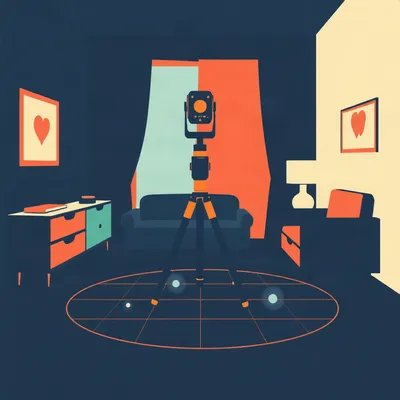
The market splits into two categories right at the door. Terrestrial laser scanners — tripod-mounted, stationary, survey-grade — and handheld SLAM units, which you walk through a space carrying. The difference isn't just form factor. It's accuracy, speed, and what kind of project you're doing.
At the entry level of dedicated hardware — and I mean the real entry level, not a phone on a tripod — you've got the Matterport Pro3. It runs about five thousand dollars. But here's the thing people miss: it has a mandatory subscription. Seventy dollars a month, or seven hundred a year if you pay annually. You cannot use the camera without it. That subscription is where Matterport makes its money, and it locks you into their cloud platform for processing. Small studios doing real estate walkthroughs and interior documentation — this is the default choice. The output is polished and client-ready, but you're renting the pipeline forever.
Five grand up front and then a permanent seventy-dollar-a-month leash. That's a business model, not a tool purchase.
It is. And it's why the next rung up is where things get interesting for actual design practices. The Leica BLK360 G2 — that's the current generation — runs about eighteen to twenty thousand dollars. Five millimeter accuracy at ten meters, full three-sixty spherical capture in under twenty seconds per scan position. No mandatory subscription. You own the data, you process it locally or however you want. This is the scanner I see small to mid-size architecture firms actually buying. It's fast enough to scan a two-thousand-square-foot apartment in a couple of hours, and the accuracy is sufficient for interior design and renovation work.
And then the price curve gets steep fast.
Right. Mid-range, you're looking at the Faro Focus Premium — thirty to thirty-five thousand dollars. One millimeter accuracy at ten meters, integrated HDR imaging so the color data is actually usable, and it's fast. Faro uses phase-shift measurement, which I'll get to, but the practical upshot is it captures about a million points per second. You can do a full three-sixty scan with color in under a minute. This is the workhorse for firms doing commercial interiors, hospitals, offices — anywhere you need density and speed.
And above that?
The NavVis VLX three is a wearable system — you put it on like a vest with sensors on your shoulders and a head unit — and you just walk through the space. Sixty to seventy thousand dollars. It's doing SLAM — simultaneous localization and mapping — building the point cloud continuously as you move. No tripod, no stopping. A two-thousand-square-foot apartment takes twenty minutes instead of two hours. But the accuracy is one to three centimeters, not one to five millimeters. Different tool for different jobs.
At the top end, you've got the Leica RTC360 at fifty to sixty thousand, which is the fast high-accuracy unit a lot of survey firms standardize on. And then the Leica P-series — the P50 exceeds eighty thousand dollars — for long-range survey work, infrastructure, bridges, things where you're scanning from hundreds of meters away. That's not interior design territory, but it's what's out there.
So the hardware ladder runs from five thousand to over eighty. But you said something earlier that I want to sit with. The hardware cost is often less than the software and labor cost over a year.
It is, and it's the thing most first-time buyers don't budget for. A thirty-thousand-dollar scanner is a capital expense you can amortize. But the software subscriptions — Leica Register 360, Faro SCENE, Autodesk ReCap Pro, NavVis IVION — these add thousands per year per seat. And the labor — a skilled technician to do registration and cleanup runs fifty to a hundred dollars an hour, and a fifty-scan project can eat eight to ten hours just in processing and manual cleanup. That's per project. Do one a month and you've spent more on labor than the scanner cost within eighteen months.
So the scanner is the cheap part. Good to know before you sign the purchase order.
And that's before we even talk about scan-to-BIM modeling, which is where the real money goes. But we'll get there.
Let's back up to the physics. A price tag only tells you so much. How do these things actually measure a space?
Two main principles for terrestrial scanners: time-of-flight and phase-shift. Time-of-flight is exactly what it sounds like — the scanner emits a laser pulse, it hits a surface, bounces back, and the scanner measures how long that round trip took. Since the speed of light is a known constant, you get distance. Time-of-flight scanners can reach hundreds of meters — the Leica P50 does long-range survey work this way — but they're slower per measurement because you're waiting for each pulse to return.
Phase-shift modulates the laser's amplitude continuously and measures the phase offset between the emitted and returned signal. It's faster — much faster — because you're not waiting for individual pulses. The Faro Focus Premium uses phase-shift, which is why it can capture a million points per second. The trade-off is range — phase-shift tops out around a hundred meters, sometimes less depending on surface reflectivity.
So Faro chose speed, Leica chose range. Or at least their high-end units did.
The RTC360 actually uses time-of-flight but with a waveform digitizing approach that makes it fast anyway — Leica's proprietary tech. But the basic split holds: time-of-flight for range, phase-shift for speed. For interior work, phase-shift is usually the right call. You don't need three hundred meters of range in a living room.
And what's actually happening mechanically during a scan?
The laser sits on a rotating base that spins on the vertical axis, and inside the head a mirror spins on the horizontal axis. The laser bounces off the mirror, hits the room, returns. The two axes of rotation create a dense spherical grid of points — millions of them, each with an X, Y, Z coordinate and usually an intensity value that tells you how reflective the surface was. The integrated cameras then capture HDR imagery and the software maps color onto each point. What you get is a three-sixty-degree colored point cloud from a single position.
And you can't just use one scan.
Occlusion. Every scanner has line-of-sight. A sofa blocks the wall behind it. A column blocks whatever's on the other side. A door frame obscures part of the adjacent room. A single room might need five to fifteen scan positions to capture everything without shadows — and "shadow" here means a cone of missing data, not darkness. A whole floor of an office could require fifty to a hundred scans. Each one is a separate point cloud in its own local coordinate system, with no idea where it sits relative to the others.
Which is where the post-scan workflow begins. You've got dozens or hundreds of individual point clouds, each in its own little universe.
And they have to be registered — aligned into a single global coordinate system — before anything else can happen. That's step one, and it's where a lot of projects go to die if nobody budgeted the time.
So you've got your scans — dozens of them. Now what? This is where the real work begins.
Registration. Two methods, and which one you use depends on the site and the scanner. Target-based registration means you place physical spheres or checkerboard targets in the scene before you scan. The software recognizes these across multiple scans and uses them as tie points to align everything. It's reliable but slow — someone has to place and collect the targets, and you need line-of-sight between scan positions and targets. Cloud-to-cloud registration skips the targets entirely. The software looks at overlapping geometry between scans and algorithmically matches surfaces to find the best alignment. It's faster on site but less reliable in featureless spaces — long empty corridors, open-plan offices with uniform ceiling grids, anything where the geometry is repetitive and the algorithm can't find unique features to latch onto.
And in practice you're probably doing both — targets for the tricky bits, cloud-to-cloud for the rest.
And the software landscape here is vendor-specific in ways that matter. Leica Register 360 for Leica scanners, Faro SCENE for Faro, NavVis IVION for NavVis. Each has its own registration engine, and while you can export raw data and try to register in something else, the best results come from staying in your hardware vendor's ecosystem. That's not an accident — it's part of the business model.
Lock-in by point cloud format. A new kind of vendor captivity.
And then there's Autodesk ReCap Pro, which sits in a weird position. It's not tied to any one scanner, and a lot of firms use it as the final step before bringing point clouds into Revit. ReCap converts raw formats — dot E fifty-seven, dot L A S — into dot R C P or dot R C S files that Revit can actually read. But ReCap's registration tools are weaker than the vendor-specific packages. So the typical workflow is: register in the vendor software, export a unified point cloud, then bring it into ReCap for conversion and maybe some final cleanup.
And how long does registration actually take?
A fifty-scan project — which is a medium-sized commercial interior, maybe ten thousand square feet — takes four to eight hours of processing time. The software is crunching millions of points, iteratively aligning clouds, and the compute is non-trivial. Then you need one to two hours of manual cleanup on top of that. Removing moving objects — people who walked through the scan, cars that drove past a window, ghost reflections from glass and mirrors. Glass is a nightmare for laser scanners because the beam partially reflects and partially passes through, creating phantom points floating in space. Someone has to go in and delete those by hand.
So a day and a half of skilled labor just to get the point cloud into one piece. And we haven't touched the modeling yet.
Before modeling, there's more cleanup. A unified point cloud from fifty scans might have five hundred million points. That's too heavy for most design software to handle smoothly. You have to subsample — reduce the density intelligently, keeping detail where it matters and thinning out flat featureless surfaces. You also need to do color balancing if the scanner captured imagery, because lighting conditions change between scan positions and you get visible seams where scans overlap. All of this is technician time at fifty to a hundred dollars an hour.
Then the conversion problem. Revit doesn't just open a point cloud.
No design software natively edits point clouds. Revit imports them via ReCap Pro in dot R C P or dot R C S format, but they're reference-only. You can snap to points, you can slice sections through the cloud, you can measure — but you cannot modify the point cloud itself. It's a visual guide. For Rhino, you can import dot E fifty-seven directly, which is nice, but performance falls apart above about fifty million points. SketchUp needs a plugin and chokes on anything dense. AutoCAD can handle dot R C P files but the workflow is clunky.
The point cloud sits there as a ghost — visible, measurable, but untouchable — and someone has to trace over it.
Scan-to-BIM. This is the real bottleneck, and it's where the money goes. A registered, cleaned, subsampled point cloud is still just a visualization aid. Someone — a BIM modeler, usually — has to manually trace walls, floors, ceilings, columns, beams, and MEP elements to create an actual building information model. Every wall has to be modeled. Every door frame. Every pipe that matters. The level of detail determines the time.
LOD two hundred — that's approximate geometry, generic objects, no manufacturer-specific data — might take ten to fifteen hours per thousand square feet. LOD three hundred — accurate geometry with specific components — more like twenty to thirty hours. LOD four hundred — fabrication-ready detail with every bolt and weld — can hit forty hours per thousand square feet or more. A ten-thousand-square-foot office renovation at LOD three hundred is three weeks of full-time modeling work.
Three weeks. And the scanning took one day.
One day on site with a Faro Focus. Maybe two days for registration and cleanup. Three weeks for the model. Total project cost — fifteen to twenty-five thousand dollars, of which the scanner amortization is maybe five hundred bucks. The hardware is the smallest line item.
This is the thing I think most people outside the industry don't understand. They see a firm buy a thirty-thousand-dollar scanner and think that's the investment. But the scanner is just the entry ticket. The real cost is the human being who knows how to turn those points into something a contractor can bid from.
That human is expensive and hard to find. There are firms that bought scanners, did one project, and now the thing sits on a shelf because they didn't budget for the pipeline. They thought the point cloud was the deliverable. It's not. A point cloud is raw data. It's like handing a client a hard drive full of CSV files and saying "there's your financial analysis."
At what practice size does it actually make sense to buy rather than hire a survey firm?
That's the right question. If you're doing one or two projects a year that need scanning, hire it out. Survey firms charge maybe fifteen hundred to three thousand dollars for a day of scanning plus basic registration, and they deliver a registered point cloud. You're paying for the equipment, the technician, and the expertise — and you're not carrying a thirty-thousand-dollar asset that depreciates and needs software subscriptions.
If you're doing a project a month, the math shifts. Twelve projects a year at two thousand dollars each is twenty-four thousand dollars. A BLK three-sixty G two at eighteen thousand pays for itself in nine months — but only if you've got someone on staff who can run it and do the post-processing. That person's salary is the real recurring cost, not the scanner payment.
The break-even isn't about the hardware at all. It's about whether you can keep a skilled technician fed with enough work to justify the headcount.
That's why the mid-size firms are the sweet spot for this equipment. Small enough that every project matters, large enough that scanning is a regular need. The solo practitioner or the two-person studio — they're almost always better off hiring a surveyor. The hundred-person firm with a dedicated BIM department — they buy the RTC three-sixty and a couple of BLKs and it's just part of the toolkit.
What about the handheld SLAM units? The NavVis and the GeoSLAM? Where do those fit in the buy-versus-hire calculus?
Different use case. Handheld SLAM is for speed and coverage, not precision. If you're scanning a hospital wing or a university campus — huge, complex spaces with lots of rooms — a tripod-based scanner takes forever. You're setting up, leveling, scanning, moving six feet, doing it again. A NavVis VLX lets you walk continuously and capture the whole thing in an afternoon. The point cloud is noisier — one to three centimeters of accuracy versus one to five millmeters — but for space planning, facility management, and early-stage design, that's often good enough.
The GeoSLAM ZEB Horizon is about forty-five thousand dollars, lighter than the NavVis, and designed for rougher environments — mines, caves, forests. It's showing up in architecture for large site documentation, but it's really a surveyor's tool. The drift accumulation is the problem with all SLAM systems. Over a long path, small errors compound. You need loop closure — physically returning to a known point so the algorithm can correct the drift — and in a building with lots of rooms, that's not always practical.
The SLAM units trade accuracy for speed, and the tripod units trade speed for accuracy. Nobody's solved both.
Not at the same price point. The RTC three-sixty is fast for a tripod scanner, but you're still stopping and setting up. The NavVis is continuous, but you're accepting centimeter-level noise. The holy grail would be a SLAM system with survey-grade accuracy and no drift, and that's... not here yet.

Leica Disto D five ten.
What?
Three hundred eighty-nine dollars. Laser distance meter. I've got one in the truck.
Hilbert, we're talking about eighty-thousand-dollar scanners and you're pulling out a handheld laser tape.
I know what you're talking about. I spent most of nineteen seventy-nine walking around a warehouse in Connecticut with a Leica TPS twelve hundred total station and a prism on a pole. You set up the tripod, you level it — and I mean level it, the bubble had to be dead center — and then you shot the prism. One point. Then the guy with the pole moves six inches and you shoot again. We got maybe two hundred points in a day and thought we were kings of the industry.
The point cloud was a joke. You could see the shape of the building if you squinted. But the client was happy because they'd never seen anything like it. Now you've got these million-point-per-second machines producing beautiful dense colorized clouds, and clients complain the door frame is two millmeters off. The technology got better and the expectations got worse. That's the whole story.
The bottleneck moved. It used to be "can we capture enough points to see the room." Now it's "can we interpret the points correctly and model from them fast enough."
The interpretation part — deciding which points are the wall and which are a pipe and which are a reflection off a window — that hasn't changed since I was doing it. The scanner gives you more points, but someone still has to look at them and know what they're seeing. I watched a kid last year — twenty-three years old, fresh out of some tech program — spend forty-five minutes modeling a column that wasn't there. It was a stack of drywall leaning against a real column. The point cloud showed it perfectly. He just didn't know what he was looking at.
Ghost geometry. The scanner doesn't know what's permanent and what's temporary. It just records surfaces.
That's the thing. You can't automate judgment. Not yet, anyway. All these AI scan-to-BIM tools they're selling now — EdgeWise, ClearEdge, whatever Autodesk's calling theirs this quarter — they'll find pipes and walls and beams automatically. But they'll also find a coat rack and call it a structural column. Someone still has to go through and fix it. The cleanup just moved from tracing points to deleting AI hallucinations.
The scanner got better, the software got smarter, and the human is still the one who has to know what a wall looks like.
I've got a Disto in the truck and I still use it. You want to know if a door frame is plumb, you don't need a million points. You need two measurements and a brain.
The Disto is a good counterweight to all of this, actually. For a lot of interior design work — measuring a single room for cabinetry, checking clearances — a three-hundred-dollar laser meter is the right tool. The scanner is for when you need the whole building, and you need it documented in three dimensions, and you need to be able to answer questions six months later that you didn't know to ask during the walkthrough.
The scanner is an insurance policy against future questions. You capture everything because you don't know what you'll need.
We used to just go back and measure again. Took twenty minutes. Now nobody wants to make a second trip.
The Disto's still in the truck if you want to see it.
I believe you.
The open question I keep coming back to is whether the AI tools actually shrink the bottleneck or just relocate it. Right now, scan-to-BIM is the expensive part. If AI can auto-model eighty percent of a building correctly, that's huge — but the twenty percent it gets wrong has to be found and fixed, and finding errors in an AI-generated model might be harder than modeling from scratch. You're not tracing points anymore. You're auditing someone else's work, and you don't know where the mistakes are.
It's the difference between writing a document and proofreading one. Proofreading is faster, but only if the document is mostly correct. If every third sentence has an error you have to rewrite, you might as well have started from a blank page.
The errors in scan-to-BIM are spatial. A wall that's six inches off. A pipe that's assigned to the wrong system. A ceiling height that's wrong by a foot. These aren't typos — they're geometry problems that cascade through the model. The structural engineer designs to the wrong column grid. The MEP contractor orders pipe that doesn't fit. The cost of a missed error is enormous.
The AI pitch is "faster modeling," but the reality might be "faster modeling with higher-stakes errors."
The firms I've talked to who are using these tools say they're saving maybe thirty to forty percent on modeling time, but they've added a QA step that didn't exist before. Net time savings — maybe twenty percent. Which is real money on a three-week project. But it's not the revolution the marketing implies.
The cutting-room floor detail I had from the research — and this one surprised me — is that the dot E fifty-seven file format, which is the open standard for point cloud exchange, was originally developed for a product called the Leica ScanStation. The format is named after the ASTM E fifty-seven committee on 3D imaging systems. It's an open standard, anyone can implement it, and it's one of the few vendor-neutral things in this whole pipeline. But it's also a container format that can hold almost anything — points, images, metadata — and that flexibility means different software packages implement it differently. An E fifty-seven out of Faro SCENE is not quite the same as an E fifty-seven out of Leica Register. The standard is open, but the implementations aren't quite interoperable in practice.
That's the whole industry in one sentence. Open standards, closed implementations.
The dedicated hardware market is mature. The scanners are fast, accurate, and the price bands are well-established. But the workflow around them is still the wild west — every firm has their own stack of software, their own pipeline, their own person who knows the quirks. The next revolution in spatial measurement won't be a better scanner. It'll be software that makes the point cloud disappear into the model without someone spending three weeks tracing walls.
Hilbert's point stands — judgment isn't automatable yet. The scanner sees surfaces. The human sees a room.
Thanks to Hilbert Flumingtop for producing.
This has been My Weird Prompts.
We'll be back soon. Email us at show at my weird prompts dot com.