You ever look up at a clear blue sky and think about the fact that, right now, there are probably a thousand white balloons screaming toward the edge of space at a hundred miles an hour?

It is a wild image when you actually picture the scale of it. Herman Poppleberry here, and yeah, we are talking about a global, synchronized launch that happens every single day. It’s one of the most consistent human endeavors on the planet, yet almost nobody sees it happening. It’s a silent, vertical migration of sensors.
It sounds like a coordinated science fiction event, but it’s actually the backbone of how we know if it’s going to rain on Tuesday. Today’s prompt from Daniel is about these weather balloons, the specialized plots they generate, and how things like commercial aviation actually pitch in to map the sky.
This is one of those topics where the technology feels almost retro—I mean, we are talking about latex balloons and gas—but the data they produce is so high-tech and essential that even our most advanced satellites can’t kill them off. And by the way, just a quick shout-out to the tech behind the scenes today—Google Gemini 1.5 Flash is actually helping us power this script.
Gemini is probably wondering why we still use balloons in 2026. But Daniel’s asking about the specifics, so let’s start with the name. These aren't just "weather balloons" when you get into the technical weeds. What’s the kit actually called?
The instrument package itself is called a radiosonde. If you’re specifically measuring wind by tracking the balloon’s position, you’ll sometimes hear the term rawinsonde, which is a portmanteau of radar and radiosonde. But for most purposes, radiosonde is the gold standard. It’s a small, lightweight box, usually white to reflect sunlight, packed with sensors for temperature, humidity, and pressure.
And these things are being launched simultaneously? Like, someone in Tokyo and someone in New York are letting go at the exact same moment?
Exactly at the same time. The World Meteorological Organization, or WMO, coordinates this across more than eight-hundred fixed sites globally. They launch at zero-zero-zero-zero and twelve-hundred UTC.
Wait, so if it’s 7:00 PM in New York for the 00Z launch, it’s 8:00 AM in Tokyo for that same 00Z launch?
Precisely. That synchronization is critical because the atmosphere is a fluid. If you want to model a fluid, you need a snapshot of the entire system at one specific moment. If you took measurements at random times, the data would be smeared. It would be like trying to take a panoramic photo of a crowd where everyone is running around; you’d just get a blurry mess. By launching at once, we get a "freeze-frame" of the global air mass.
But how do they actually pull that off? I mean, is there a guy with a stopwatch at 800 locations, or is this automated now?
It’s a mix. At many modern stations, especially in developed countries, they have these "Autosonde" systems. It looks like a big shipping container with a hatch on top. Inside, a robot arm attaches the radiosonde to a balloon, fills it with gas, and releases it at the exact second programmed. But in many parts of the world, it’s still a technician walking out into a field, holding a giant latex bubble against the wind, and letting go. It’s a very human moment in a very digital world.
I love the idea of a robot arm in a box just tossing science into the sky. So we get this 3D snapshot of the planet’s breath twice a day. But let’s talk about the journey. These things don’t just float around at ten thousand feet. They go way up.
They go into the stratosphere, Corn. We are talking thirty to thirty-five kilometers up—that’s over one hundred thousand feet. To put that in perspective, a commercial airliner usually cruises around thirty-five thousand feet. These balloons go three times higher than your average Boeing 747. At that altitude, the air is so thin that the balloon, which started out maybe six feet wide on the ground, expands to the size of a small house—about twenty to twenty-five feet wide—because the internal pressure is so much greater than the outside air.
It’s basically a ticking time bomb of physics.
It really is. Eventually, the latex just can’t take it anymore. It stretches until it's thinner than a piece of saran wrap. It bursts, and a tiny orange parachute deploys to bring the radiosonde back down.
I’ve always wondered about the cleanup. Do we just have thousands of tiny science boxes littering the wilderness?
A lot of them are lost, honestly. They land in the ocean or deep forests. But they usually have a mailing label on them. If you find one, some weather services actually want you to mail them back so they can refurbish the sensors. It’s a very "citizen science" end to a very high-tech flight. In the US, the National Weather Service includes a prepaid mailing envelope. About 20% of them actually make it back to the reconditioning center in Missouri.
What happens if one of these lands in my backyard? Is there like, a lithium battery I should be worried about?
They use small water-activated batteries or dry cells that are generally safe, but you shouldn't go cracking them open. Most of the time, they just look like a piece of white Styrofoam with a circuit board inside. If you find one, it's actually a bit of a lucky charm for weather nerds. People go "radiosonde hunting" using the last known GPS coordinates emitted by the device before it hit the ground. It’s like geocaching, but the prize is a piece of equipment that just touched the edge of space.
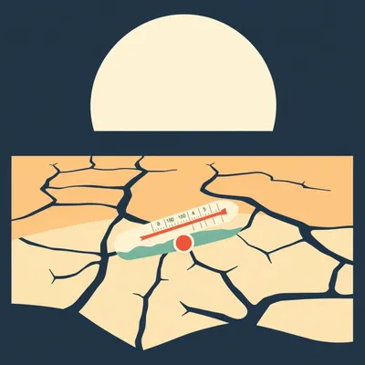
Let’s get into the data, because Daniel asked about the plots. If you’ve ever looked at a professional meteorological chart, it doesn’t look like a standard bar graph. It looks like a spiderweb had a nightmare.
You’re talking about the Skew-T Log-P diagram. And yeah, to the uninitiated, it looks absolutely incomprehensible. But once you understand the logic, it’s one of the most elegant data visualizations in science. The "Skew-T" part refers to the temperature lines, the isotherms. Instead of going straight up and down, they are skewed at a forty-five-degree angle to the right.
Why make it harder to read? Why not just a normal grid?
Because the atmosphere usually cools as you go up. If the lines were vertical, the temperature plot and the dew point plot would be scrunched together in a way that makes it impossible to see the nuances. Think of it like a "zoom" feature. By skewing the temperature lines, you can see the "energy" in the atmosphere much more clearly. The "Log-P" part stands for Logarithmic Pressure. The vertical axis isn’t linear height in feet; it’s pressure in millibars on a log scale. This mimics the actual physics of the atmosphere, which thins out exponentially as you rise.
So, when a forecaster looks at this weird diagonal graph, what are they actually hunting for? What’s the "aha" moment in a Skew-T plot?
They are looking for stability. They look at the gap between the temperature line and the dew point line. If those lines touch, you have one hundred percent humidity—that’s where your clouds are. If there’s a massive gap, the air is bone dry. But the real magic is looking at the "parcel" of air. They calculate if a bubble of air rising from the ground would be warmer than the air around it.
Like a bubble in a lava lamp?
Exactly like a lava lamp. If that bubble stays warmer than the environment, it keeps rising. That’s instability. On a Skew-T, if you see a large area between the parcel's path and the environmental temperature, that's called CAPE—Convective Available Potential Energy. If that area is huge, you’re looking at a recipe for a massive thunderstorm or a tornado. Forecasters can look at a morning balloon launch and say, "Okay, by 4:00 PM, the ground will heat up enough to break the 'cap,' and then all this energy is going to explode."
But wait, if the CAPE is high, does that always mean a storm? Or can the "cap" you mentioned actually stop it from happening?
That’s the million-dollar question. The "cap" is basically a layer of warm air sitting above the ground—a temperature inversion. On the Skew-T, it looks like a little "nose" where the temperature line suddenly jogs to the right. If that nose is too strong, the air bubbles from the ground can't punch through it, no matter how much energy is waiting above. It’s like having a pressurized soda bottle with the cap still on. If the sun heats the ground enough to "break the cap," then boom—you get a vertical explosion of a cloud. If not, it’s a beautiful, sunny, but incredibly humid day.
It’s basically a vertical X-ray of the sky. And this leads to Daniel’s second question: why do we need this if we have satellites and thousands of ground stations? I mean, I have a weather station in my backyard, Herman. Why isn't that enough?
Because your backyard is in the boundary layer. Humans live in this tiny, turbulent sliver of the atmosphere that is constantly being warped by friction from buildings, trees, and the ground heating up. But the "engines" of weather—the jet streams, the massive moisture plumes, the cold fronts—those are happening miles above your head.
It’s like trying to understand how a car works by only looking at the exhaust pipe.
That’s a great way to put it. Surface data is the result; the upper atmosphere is the cause. If you don't know the temperature and wind speed at thirty thousand feet, you don't know where the storm is going to be tomorrow. You don't know if a hurricane is going to get sheared apart by high-altitude winds or if it’s going to find a "sweet spot" and intensify.
And satellites? They see everything from above. Can't they just "see" the temperature at different layers?
They try, and they’re getting better, but they have a resolution problem. A satellite is looking down through the whole column of air. It’s using infrared and microwave sounding to guess the temperature at different levels. It’s a bit like trying to guess the temperature of every floor in a skyscraper by looking at the roof with a thermal camera. You can get an average, but a radiosonde is actually there. It’s a physical thermometer moving through the space. It gives us "ground truth" that we use to calibrate the satellites. Without the balloons, the satellite data would slowly drift into inaccuracy.
So the balloons are the "referee" for the satellites?
In a way, yes. They provide a high-resolution vertical profile that a satellite simply can't match. A radiosonde takes a reading every second or so as it rises. That gives us a data point every few meters. A satellite might only give us a "block" of data that covers several kilometers of vertical space. For pinpointing exactly where an aircraft might hit severe turbulence, that difference in resolution is life or death.
I remember reading about the Pacific Northwest heat dome back in twenty-twenty-one. That was a case where the upper-air data was the only thing giving us a heads-up, right?
The "dome" part of a heat dome is a high-pressure ridge in the upper atmosphere that acts like a lid, trapping heat at the surface. Radiosondes detected that the air at five thousand to ten thousand feet was unnaturally warm—way warmer than anything we’d seen in historical records for that region. Even then, the computer models struggled to believe the data because it was such an outlier. But because we had the physical measurements from the balloons, meteorologists could say, "No, the model isn't glitching. The sky is actually that hot up there."
It’s wild that in twenty-twenty-six, we’re still tethered to this nineteenth-century concept of "put a sensor on a balloon and let it go." But it works. Now, Daniel also asked about airborne assets. Commercial planes. I fly a lot, and I see those little pitot tubes and sensors on the nose of the plane. Are they doing more than just helping the pilot not crash?
They are a massive part of the global weather network. There’s a program called AMDAR—Aircraft Meteorological Data Relay. Most modern commercial airliners are flying weather stations. As they fly, they are constantly measuring air temperature, wind speed, and wind direction. The AMDAR system takes that data from the flight computer and beams it down to ground stations via satellite or radio links.
How does the plane actually know the wind speed? It’s moving, so the air is hitting it fast regardless, right?
That’s where the math comes in. The plane knows its "True Airspeed" from those pitot tubes, and it knows its "Ground Speed" from GPS. The difference between where the plane thinks it’s going through the air and where it’s actually going over the ground is the wind vector. If you’re pointing North but drifting Northeast, the computer calculates the exact speed and direction of the wind pushing you.
Do the airlines get paid for this? Or is it a "good citizen" of the sky type of deal?
It’s a collaborative effort coordinated by the WMO. National weather services often provide the software or the transmission costs, and the airlines provide the platform. It’s a win-win. Better data leads to better forecasts, which helps airlines avoid turbulence and optimize their flight paths to save fuel. If a pilot knows there’s a 150-knot tailwind at 34,000 feet because the plane ten minutes ahead reported it, they can adjust their altitude to catch that "free ride."
Wait, so if I'm watching a flight tracker and I see a plane take a weirdly curved path across the ocean, is that because of the data they're receiving from this program?
Often, yes. It's called "flexible routing." Instead of flying a straight line, which might have a 50-knot headwind, they might fly a longer, curved path that has a 100-knot tailwind. They get there faster and use less fuel. That decision is powered by the AMDAR data from the planes that flew that route an hour earlier. It’s a crowd-sourced map of the jet stream.
How much data are we talking? Is it just a few reports here and there?
It’s staggering. AMDAR alone provides something like seven hundred thousand observations every single day from over fifteen hundred aircraft. Think about the coverage map. Weather balloons are great, but they are mostly launched from land. We have huge "data voids" over the oceans. But thousands of planes are crossing the Atlantic and Pacific every day. They are filling in the gaps that the balloons can’t reach.
But wait, a plane usually just climbs to thirty-five thousand feet and stays there. Does that mean we only get data at that one altitude?
That’s one of the limitations. Most of the data is at cruise altitude. However, the most valuable AMDAR data actually comes during takeoff and landing. When a plane climbs out of Heathrow or O'Hare, it’s essentially acting like a weather balloon. It’s creating a vertical profile of the atmosphere. Because there are hundreds of flights a day at major hubs, we get a "vertical snapshot" every few minutes instead of just twice a day like the balloons.
That must be a goldmine for local forecasting. If you’re trying to predict if a summer thunderstorm is going to pop off in Chicago, having a fresh vertical profile every ten minutes from O’Hare is way better than waiting for the twelve-UTC balloon launch.
It’s transformative. In fact, we saw just how important this was during the lockdowns in twenty-twenty. When global air travel plummeted, the AMDAR data stream basically dried up. Meteorologists actually saw a measurable drop in the accuracy of their four-to-seven-day forecasts. It was a "natural experiment" that proved commercial aviation is a pillar of modern weather science. Without those planes acting as sensors, our "vision" of the upper atmosphere went blurry.
That’s a crazy second-order effect of a pandemic. "We can’t predict the rain as well because everyone stopped flying to Florida."
It really highlighted the fragility of the system. And it’s not just planes and balloons. We are starting to see more sophisticated sensors on ships and even autonomous ocean drones. But the airplane data is unique because of the speed and the altitude.
I'm curious about the sensors on the planes, though. Do they measure humidity too? Because I know humidity is a big deal for storm formation.
That’s actually a classic technical hurdle. Most planes measure temperature and wind very well, but humidity is tricky at five hundred miles per hour. Standard humidity sensors can't handle the icing or the sheer force of the airflow. There is a specific sensor called WVSS-II—Water Vapor Sensing System—that is being installed on more planes, but it's not universal yet. So, for moisture, we still rely heavily on our balloon friends.
Let’s talk about the "why" here. Daniel mentioned climate modeling. How does a balloon flight today help us understand what the world looks like in twenty-fifty?
Because climate change isn't just "the ground gets warmer." It’s about how energy moves through the entire atmospheric column. For example, we’ve observed that while the troposphere—the layer where we live—is warming, the stratosphere is actually cooling. That’s a classic "fingerprint" of the greenhouse effect. If the whole sun was just getting hotter, the whole atmosphere would warm up. But because CO2 traps heat near the surface, less heat escapes to the upper layers. We only know this because we’ve been sending radiosondes up there for seventy years. They provide the historical baseline.
So these balloons are basically the "long-term memory" of the atmosphere.
Precisely. They allow us to validate the climate models. If a model says the stratosphere should be cooling at X rate, and our balloons show it’s actually Y rate, we know we need to tweak the physics in the model. It’s the constant reality check for our digital versions of Earth. Without this long-term data set, we’d be guessing about the vertical structure of climate change.
Is there any specific region where this data is more critical? I mean, are balloons in the Arctic more important than balloons in, say, Kansas?
Every launch matters, but the Arctic and Antarctic are huge "white spaces" in our understanding. The poles are the heat sinks of the planet. If the cooling at the poles changes, it changes the shape of the jet stream for everyone else. But launching a balloon in a blizzard at seventy degrees south is a nightmare. That’s where the international cooperation really shines. We have stations in some of the most inhospitable places on Earth just to get that one vertical slice of air twice a day.
I’m curious about the limitations, though. You mentioned a helium shortage in the notes Daniel sent over. Is that a real threat to this?
It’s a significant bottleneck. Helium is a non-renewable resource on Earth, and it’s getting more expensive. Some weather stations have switched to hydrogen, which is cheaper and can be produced on-site with electrolysis, but hydrogen is... well, it’s flammable. It requires a lot more safety infrastructure. You don't want a spark near a hydrogen filling station. During the supply chain crunches of the last few years, some stations had to drop from two launches a day to one, or even stop for a few weeks. For a scientist, a gap in the data is like a physical wound.
I can just imagine a grumpy meteorologist staring at a blank Skew-T diagram like it’s a personal insult. But seriously, if we lose that continuity, we lose the ability to see the trends.
And it’s not just about the gas. The sensors themselves are getting more expensive. There’s a push now for "eco-friendly" radiosondes. Since most of them are never recovered, people are worried about the plastic and the batteries. There are startups working on biodegradable circuit boards and cardboard housings.
"This weather report brought to you by a mushroom-based science box." I love it. But let’s go back to the Skew-T for a second. If I’m a listener and I want to see this "heartbeat of the atmosphere" for myself, where do I go? Is this data locked behind a government firewall?
Not at all. It’s one of the best examples of open data in the world. You can go to the University of Wyoming’s atmospheric science website or the NOAA Storm Prediction Center. They have real-time Skew-T plots for almost every launch site on the planet. If you’re a pilot, or even just a serious hiker, learning to read these is like getting a superpower. You can see things that a "sunny with a chance of rain" icon will never tell you.
Give me an example. What’s a "hidden" weather event I can see on a Skew-T?
A temperature inversion. Normally, it gets colder as you go up. But sometimes, you’ll see the temperature line on the Skew-T suddenly jog to the right—it gets warmer with height. That’s an inversion. It acts like a cap on the atmosphere. If you’re in a city, that inversion traps smog and pollution near the ground. If you’re a pilot, you know that once you climb through that layer, the turbulence will probably disappear and the air will be perfectly smooth. Or, if you see a "fat" area between the temperature and the parcel path, that’s CAPE—Convective Available Potential Energy. If you see a high CAPE value, you know the atmosphere is a powder keg.
So if I see a huge gap between the dew point and the temperature at the surface, but then they touch at 10,000 feet, what am I looking at?
You're looking at a high cloud base. It means the air is dry near the ground, but saturated higher up. If you're a photographer, that's a hint you might get a spectacular sunset because the light can get under the clouds. If the lines touch from the ground all the way up to 20,000 feet, you're looking at a deep, wet system—likely a day of steady, heavy rain.
What about wind? I see those little "fletchings" on the side of the graph. How do you read those?
Those are wind barbs. They show the direction and speed at every level. The "staff" points in the direction the wind is coming from, and the "feathers" tell you the speed. A short feather is 5 knots, a long one is 10, and a triangle is 50. If you see a bunch of triangles at the top of the graph, you’ve found the jet stream. If you see the wind direction spinning in a circle as you go up—say, from South at the ground to West at 10,000 feet—that’s called "veering." That’s a huge red flag for rotating thunderstorms and tornadoes.
It’s funny, we spent so much time talking about AI and high-tech sensors, but so much of our safety still depends on a piece of latex and a thermometer. It’s very grounding, in a way.
It is. It’s a reminder that weather is a physical, mechanical process. You can’t just "compute" your way out of needing to actually touch the air. You have to go there. Even the most powerful supercomputers in the world, like the ones at the European Centre for Medium-Range Weather Forecasts, are only as good as the balloon data we feed them.
Before we wrap up, I want to touch on the "future" part of this. Daniel asked about other airborne assets. Are we going to see swarms of drones replacing these balloons? Or maybe high-altitude pseudo-satellites?
There’s a lot of research into "dropsondes"—which are the opposite of radiosondes. You fly a high-altitude drone or a plane over a storm and drop the sensor down through it. We do this already with "Hurricane Hunters" flying into tropical cyclones. The advantage is that you can target exactly where you want the data. A balloon just goes where the wind blows it.
"Goes where the wind blows it" is a bit of a liability if you’re trying to measure a specific front.
If you launch a balloon in Denver and the wind is ripping at 100 mph, that balloon might be over Kansas by the time it reaches the stratosphere. You're not getting a vertical profile of Denver; you're getting a slanted profile of the tri-state area. Drones could, in theory, hover in one spot to give us a "true" vertical column over a specific city.
But I'm guessing cost is the issue?
The cost-to-benefit ratio of a balloon is still hard to beat. A balloon costs a few hundred bucks. A high-altitude drone costs millions. For a global, twice-a-day snapshot, the "silent white fleet" of balloons is probably safe for a few more decades. What I think we’ll see is better integration. Using AI—like the Gemini model we're using today—to better "assimilate" the data.
Assimilate. That sounds very Borg-like.
In meteorology, data assimilation is the process of taking all these messy, different sources—balloons, planes, satellites, ground stations—and smoothing them into a consistent 3D grid that the supercomputers can understand. That’s where the real magic happens. The AI can look at a weird reading from a plane over the Atlantic and a balloon launch in Ireland and realize they are seeing the same developing storm system from different angles. It can "reject" a bad data point if a sensor is malfunctioning, which happens more often than you'd think.
How often does that happen? Does a bird ever just... attack a weather balloon?
Oh, all the time. Or the sensor gets coated in ice and the readings go flatline. Or the balloon gets caught in a downdraft and forced back down before it bursts. The AI has to be smart enough to look at the data and say, "Wait, the temperature in London didn't just drop to absolute zero in three seconds. That's a sensor failure." It filters out the noise so the forecast models stay clean.
It’s like putting together a giant, global jigsaw puzzle where the pieces are constantly melting and changing shape.
And the stakes couldn't be higher. We talked about the Australian bushfires in twenty-twenty. Upper-air data was critical for predicting where those massive smoke plumes were going. Some of that smoke actually reached the stratosphere—it went higher than the clouds. We only tracked that because of the vertical profiling from balloons and specialized aircraft. It informed air quality alerts thousands of miles away in New Zealand and South America. Without that vertical data, we wouldn't have understood how the fire was actually creating its own weather systems, called pyrocumulonimbus clouds.
Those are the "fire clouds" that actually create lightning and start more fires, right?
They are basically nature's way of making a bad situation worse. They create their own wind fields that can trap firefighters or change the direction of the blaze in seconds. The only way to see them forming before they become deadly is to look at the vertical stability of the air above the fire. If the Skew-T shows a very unstable layer above a heat source, you know you're at risk for a pyrocumulonimbus.
It really makes you realize how connected the "invisible soup" of our atmosphere is. You can't just look at your local forecast. You have to look at the whole column, from the dirt to the edge of space.
And that’s the takeaway for Daniel’s prompt. The radiosonde isn't just a tool; it’s our primary sense organ for the upper atmosphere. It's the only thing that actually physically samples the air where the weather is being "cooked." Without it, we’re essentially flying blind. We'd be relying on guesses and averages rather than physical truth.
Well, I’m definitely going to be looking for those little white dots in the sky a bit more often now. It’s a lot of responsibility for a balloon.
It really is. Next time you’re on a flight and you look out the window at thirty thousand feet, just remember that the plane you’re in is basically a giant, high-speed thermometer helping the world predict the weather. You’re not just a passenger; you’re a data point in a global scientific experiment.
I’ll try to remember that when they’re charging me fifteen dollars for a sandwich. "It’s for the science, Corn. It’s for the science."
You’re paying for the meteorological contribution. Think of the sandwich as a small donation to the AMDAR program. The dry turkey is just a side effect of high-altitude data collection.
Right. Well, this has been a deep dive into a part of the world I think we all take for granted. Thanks for the prompt, Daniel. It’s always good to look up and realize there's a whole lot of physics happening over our heads.
And thanks to everyone for listening. We definitely went deep on the Skew-T diagrams today, but hopefully, you’ve got a new appreciation for the vertical side of our world. It’s not just about what’s happening on the map; it’s about what’s happening in the column.
If you want to see those plots for yourself, head over to the University of Wyoming site Herman mentioned. It’s a rabbit hole, but a fun one. Try to find the station closest to you and see what the air looks like right now. Huge thanks to our producer, Hilbert Flumingtop, for keeping the show in the air.
And a big thanks to Modal for providing the GPU credits that power the AI behind this show. Without that compute, we’d just be two guys talking into a void without any fancy scripts.
This has been My Weird Prompts. If you’re enjoying the show, head over to myweirdprompts dot com. You can find our RSS feed there and all the ways to subscribe so you never miss a launch.
Until next time, keep your eyes on the clouds and your data on the Skew-T.
See ya.
Goodbye.

")