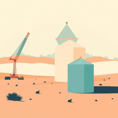
Daniel sent us this one. He's interested in open-source remote sensing — the idea that technologies visible in commercial satellite data are lagging indicators of what militaries have had for much longer. By the time a capability shows up in publicly accessible imagery, nation-states are already on to the next thing. But the open-source layers still tell you something about the shape of those classified capabilities. He specifically flagged thermal detection of missile launches, and wants us to walk through some of the less obvious sensor layers — soil composition, vegetation indices, that kind of thing — and map them onto what we can infer about military-grade surveillance. There's a lot to unpack here.

The thing that grabbed me immediately is the timing on this. As of right now, June twenty twenty-six, the gap between what the military can see and what you can pull from a free public data portal has shrunk to something almost unsettling. We're not talking decades anymore. We're talking months in some cases. The Sentinel-3 satellite from the European Copernicus program — its thermal sensor provides daily global coverage at one kilometer resolution. That same basic physics, detecting infrared radiation from hot objects against a cold background, is exactly how the US Space-Based Infrared System spots a missile launch within seconds. The principle is identical. The difference is in the engineering margins — resolution, latency, how fast the data gets downlinked and processed. And what makes this moment peculiar is that the shrinking gap isn't just about better sensors. It's about the distribution pipeline. Ten years ago, if you wanted to pull thermal satellite data, you needed a university affiliation, a grant, and probably a workstation running specialized software. Now you open a browser, authenticate with a free Copernicus account, and you're looking at yesterday's global thermal map before your coffee gets cold.
Let's frame this properly before we dive in. Walk me through the lagging indicator thesis. What exactly are we saying here?
The thesis is straightforward. Any remote sensing technique you can access today through a public portal, whether it's thermal infrared, synthetic aperture radar, or hyperspectral vegetation analysis, was almost certainly operationally deployed by military intelligence services at least five to ten years prior. And by the time we can subscribe to it, the classified world has moved on to something with higher resolution, faster revisit times, or entirely new parts of the electromagnetic spectrum. The US Space-Based Infrared System, SBIRS, achieved its first geostationary launch in twenty eleven. By the time Sentinel-3 started pumping thermal data into the public domain in twenty sixteen, SBIRS had been doing it, in a more refined way, for half a decade. And that five-year lag is actually compressed compared to historical norms. When the first Landsat launched in nineteen seventy-two, the equivalent military capability — the KH-9 HEXAGON mapping camera — had been flying for a year already, but the resolution gap was staggering. HEXAGON was resolving objects under a meter. Landsat was at eighty meters. The public wasn't seeing a lagging indicator so much as a blurry shadow of a shadow. Now the shadow has sharpened considerably.
Yet you're saying it still matters that Sentinel-3 data exists. That's the paradox.
That is the paradox. Because even though the military is years ahead on the engineering, the open-source version tells you what the category of capability is. It shows you the shape of the thing. If I can detect a missile launch plume using a free data stream with a few hours of latency, it means the military can do it in real time from geostationary orbit with sub-meter resolution. The open-source version serves as a lower bound on classified capability. You can infer the floor, and from the floor you can make reasonable guesses about the ceiling. Not precise ones, but directionally useful ones. Think of it like seeing a consumer drone with a stabilized camera gimbal in twenty fifteen. That told you something about what a military-grade quadcopter could do, even if the Reaper had been flying for a decade. The category of capability was publicly demonstrated. The engineering refinement was the classified part.
The basic approach being: whatever I can do with thirty seconds of latency and a blurry picture, the people with billion-dollar budgets can do with no latency and ridiculous precision.
And this matters more than it sounds because it tells an analyst where to look. If you want to understand what Israel or the US can detect from orbit, you don't need a security clearance to start answering that question. You need to understand what Sentinel-3's sea and land surface temperature radiometer can detect, and then you ask: what does the classified equivalent look like with lag reduced to near zero, resolution improved by orders of magnitude, and additional spectral bands? The open-source tool gives you the conceptual model. The classified tool is that model with every knob turned to eleven.
Let's start with the sensor that makes missile detection tangible. Thermal infrared from orbit. How does this actually work?
The core physics is the Planck blackbody radiation curve. Every object above absolute zero emits electromagnetic radiation. The hotter the object, the shorter the wavelength at which it emits peak radiation. For a missile exhaust plume, temperatures range from roughly eight hundred to twelve hundred degrees Celsius. At twelve hundred degrees, the peak emission sits at about two point four micrometers wavelength, and that shifts a bit depending on the exact temperature profile. The important thing is that this puts the thermal signature squarely within two atmospheric transmission windows — three to five micrometers and eight to fourteen micrometers. These are bands where the Earth's atmosphere is relatively transparent to infrared radiation. If you design your sensor to look in those windows, you can see hot objects on the surface or in the lower atmosphere from orbit.
The atmospheric windows being the wavelengths where the sky isn't in the way.
Water vapor and carbon dioxide absorb infrared at other wavelengths. You're blind if you try to look through those. It's like trying to shout across a crowded room at a frequency that the crowd itself absorbs. But the three-to-five and eight-to-fourteen micrometer bands are where the atmosphere steps aside. And that's exactly where Landsat 8 and Landsat 9 have their thermal sensors operating. Landsat 8's Thermal Infrared Sensor — they call it TIRS — has two bands. Band 10 covers ten point six to eleven point one nine micrometers, Band 11 covers eleven point five to twelve point five one micrometers. Both at one hundred meter spatial resolution. Now that resolution can't pick out individual missile launchers in most cases, but it can detect large thermal anomalies. Factory fires, gas flares, and yes — big missile plumes. The plume from something like a Shahab-3 or a Scud variant is physically large enough, and thermally bright enough, that even a one-hundred-meter pixel lights up like a beacon against the background desert or steppe terrain.
The revisit cycle?
Landsat does a sixteen-day repeat cycle. Which means you might point at a launch site and wait two weeks to catch the moment a missile goes up. That's not operationally useful for detection. It's useful for after-the-fact forensic analysis — you can confirm that a launch happened and maybe characterize the plume's thermal profile — but you can't use it for tipping and cueing. That's where Sentinel-3 comes in. Sentinel-3's sea and land surface temperature radiometer, SLSTR, has a much wider swath width — it covers the entire planet every single day, at one kilometer resolution. Lower spatial detail than Landsat, but daily temporal coverage. And for detecting something as energetically bright as a ballistic missile launch, one kilometer resolution is more than sufficient. The thermal bloom from a big rocket launch is large enough that you can spot it even at one kilometer pixels. You're not resolving the missile body. You're seeing the integrated thermal output of the plume, which can be tens of meters across and hundreds of meters long during the boost phase.
The open-source analyst is trading spatial resolution for temporal frequency, and it works because the target is sufficiently intense.
And this is not hypothetical. When Iran launched missiles during what it called Operation True Promise in twenty twenty-four, open-source analysts using Sentinel-3 SLSTR data were able to identify thermal plumes from launch sites near Isfahan and Kermanshah within hours of the launch events. They cross-referenced those thermal detections with NASA's FIRMS, the Fire Information for Resource Management System, which aggregates fire detection from the MODIS and VIIRS sensors on the Terra, Aqua, and Suomi NPP satellites. FIRMS is designed for wildfire monitoring, but the middle-infrared channels on MODIS, particularly Band 21 at three point nine micrometers, are precisely tuned to the blackbody spectrum you'd expect from hot combustion. And hot combustion describes a missile plume as well as it describes a forest fire. The physics doesn't distinguish between a wildfire and a rocket engine from the sensor's perspective — it just sees a pixel that's far hotter than everything around it. What distinguishes the two in practice is context. A thermal spike in a boreal forest in July is probably a wildfire. A thermal spike in a known missile range at two in the morning, with no lightning strikes in the area, is probably not a wildfire.
The same data feed that helps California firefighters track a blaze is what people use to figure out which Iranian launch complex lit up last night.
And the NASA FIRMS system provides that data with a latency of about three hours from acquisition. So you've got an open pipeline that, within a few hours, can tell you something very specific about a nation-state military operation. Now contrast that with SBIRS. The Space-Based Infrared System uses satellites in geostationary orbit, which means each satellite stares at a fixed region of the Earth twenty-four seven, with no revisit delay. Geostationary gives you continuous coverage — you are always watching. SBIRS sensors have resolution somewhere in the range of tens of meters at the geo distance — the exact number is classified, but our open-source estimates put it well below one hundred meters. And the data is downlinked and processed in near real time, meaning seconds, not hours. So when Iran launches a ballistic missile, the US knows before the rocket has finished its boost phase. Before the missile has even left Iranian airspace, the detection has been confirmed, characterized, and probably briefed to the National Military Command Center.
Drop the latency from three hours to three seconds and bump the resolution from one kilometer to whatever SBIRS can do. That's the gap.
That's the gap. But here's what makes the open-source window still useful. If I see Sentinel-3 detecting launch plumes at one kilometer resolution, I now know the basic detection principle works. The atmosphere is cooperative, the blackbody physics predict the signal, and the sensor sensitivity exists in commercial hardware. From that floor, I can infer that the classified platform can detect smaller launches, at shorter ranges, with greater confidence, from a permanently staring geo bird. The classified system is better in all dimensions, but the open-source version confirms that the thing is physically possible. And that's not a trivial confirmation. There are sensor concepts that look great on paper and fail in practice because of some subtle atmospheric absorption feature or unexpected background clutter. When you see the open-source version working, you know the physics survived contact with reality.
So open-source reporting that Iran has been moving TELs — transporter-erector-launchers — around desert sites near Garmsar or preparing missile brigades in the western province, you can cross-reference that with the thermal detection and build a picture of what changed between the morning briefing and someone's tweet thread.
And that's not even accounting for what the National Geospatial-Intelligence Agency can do with multi-INT fusion. They're merging the thermal signal with signals intelligence, with ground-based radar, with human intelligence sources. The thermal plume from a public sensor is one data point in a very large mosaic. But the fact that the one data point is public and verified means that the mosaic includes it, and likely includes a much sharper version of same. The public detection doesn't compete with the classified one. It corroborates it. And for the open-source analyst, that corroboration is the whole game. You're not trying to beat the NGA at their own job. You're trying to establish that a thing happened, and that the thing is detectable, and that the detection tells you something about what the people with better sensors already know.
Let me push on something here. If I'm an adversary running a missile program, and I know Sentinel-3 is going to catch my plume three hours after launch, what do I do about it? Can I mask a launch thermally?
You can try. There are tactics. You can launch during heavy cloud cover, which attenuates the thermal signal somewhat — though not completely, because the plume is so hot that some infrared energy punches through. You can launch at night, when the background surface temperature is lower and the thermal contrast is actually higher, which works against you. You can attempt to shroud the launch site with some kind of thermally reflective canopy, but the plume itself is a several-hundred-meter-long column of hot gas moving at high speed. That's not something you can hide under a tarp. The most practical countermeasure is simply to launch during a gap in the satellite overpass schedule. But with multiple public thermal sensors now in orbit — MODIS, VIIRS, SLSTR, and several others — those gaps are getting shorter. And that's before you factor in the classified assets that have no gaps at all.
We've covered thermal infrared and the missile detection use case. Let's talk about the sensor that lets you see things in the dark, through clouds. Synthetic aperture radar.
This is where I get genuinely excited. Synthetic aperture radar, SAR, is fundamentally different from optical imaging. An optical sensor on a satellite is basically a big digital camera pointed down. It captures reflected visible and near-infrared light from the sun. This means it's useless at night and useless through cloud cover — and many strategic locations on the planet spend a lot of time under cloud. The Korean peninsula, for example, particularly during the winter and summer monsoon, can go weeks with extremely limited optical visibility. If you're trying to monitor North Korean missile facilities using only optical imagery, you're going to have frustrating multi-week gaps where the entire area of interest is just a white blanket of cloud.
Missile silos don't conveniently wait for cloudless days before they start digging.
And SAR solves that. Instead of passively detecting reflected sunlight, a SAR satellite actively pings the surface with a radar beam in the C-band, around five point four gigahertz, and records the reflected signal. Radar, at that frequency, goes straight through cloud cover. It also works at night. You are your own illumination source. Effectively you're taking a flash photograph with radio waves instead of visible light. And because you control the illumination, you can do things that passive optical sensors can't — like polarimetric imaging, where you transmit and receive in different polarization states and extract information about surface texture and material properties that visible light simply doesn't carry.
The satellite brings its own flashlight.
Yes — and not only that, but by analyzing the phase of the reflected signal across the synthetic aperture that the satellite's orbit creates, you can reconstruct incredibly fine surface detail. The Sentinel-1 satellites from the European Space Agency, with their C-band SAR, provide ten meter resolution imagery with a six-day revisit when both Sentinel-1A and 1B were in the same orbital plane. Now Sentinel-1B failed in twenty twenty-two, which lengthened the revisit time, but Sentinel-1C is expected to launch — actually there's been good progress on it, and the point remains that this ten meter radar imaging capability is freely available. Ten meters means you can see individual buildings, road networks, changes in surface texture. You can't read a license plate, but you can see that a new structure has appeared where yesterday there was bare earth.
The interferometric part?
Interferometric SAR is a technique where you compare two SAR images of the same location acquired at different times, and you measure phase differences between them to detect surface displacement. We're talking deformation on the scale of two to three millimeters. You can see the ground breathe — thermal expansion of buildings, tectonic motion, and, critically, subsidence from underground construction. The way it works is elegant. If the ground surface between two satellite passes has moved toward or away from the satellite by even a fraction of the radar wavelength, the phase of the reflected signal shifts. By comparing the phase from two different acquisition dates, you can map that shift across an entire landscape. And because the C-band wavelength is about five point six centimeters, a phase shift of just a few degrees corresponds to millimeter-scale ground motion.
Subsidence as in the surface sinking because someone is digging underneath it.
Tunnel construction lowers the ground surface subtly above the spoil area. Even if the digging is deep, the removal of material causes very small but measurable surface settlement. InSAR can pick this up from orbit through any amount of cloud cover and at night. The real case study was North Korea's Sohae Satellite Launching Station expansion. In January twenty twenty-five, analysts processing Sentinel-1 InSAR data noticed a pattern of ground subsidence near the western edge of the launch complex that didn't match previous known construction. The subsidence pattern was linear and extended some ways from the primary pad infrastructure — consistent with underground tunneling or new bunker construction. The surface signature was subtle, and nothing was yet visible in optical imagery because the site was engulfed in winter cloud cover and, toward later weeks, earthworks had only partially begun. In March twenty twenty-five, when clouds finally cleared north of the thirty-eighth parallel, Planet SkySat and Maxar optical images confirmed the construction of new underground fueling and storage facilities exactly where the InSAR subsidence signal had focused months before.
They caught a bunker being built before anyone could actually see it with a camera. That is a poster child for what radar offers.
The US classified equivalent is the Future Imagery Architecture radar series, or successor systems that the National Reconnaissance Office won't confirm. Those military SAR birds are widely estimated to have sub-meter resolution and revisit times measured in hours rather than days. They fly in lower orbits and likely have onboard processing that gives the US geospatial community near-real-time deformation maps of anywhere on Earth without ever collecting an optical photon. But here's the insight again: the Sentinel-1 public dataset proves that millimeter-scale deformation detection from orbit is possible using widely available technology. The principle is identical — a C-band radar, interferometric processing, persistent scatter angle analysis. The military version sharpens the resolution and shrinks the revisit. But the technique broadcasts itself. And the fact that a free, publicly accessible satellite can detect tunneling activity from seven hundred kilometers up means the classified systems can almost certainly detect far subtler activities — smaller tunnels, deeper excavations, activities under more challenging terrain.
Which means that if an adversarial country wants to build a bunker unseen, they need to account for the fact that one kilometer of limestone doesn't make them invisible to phase differential measurement.
They can try to conceal the precise structures, but ground-settling patterns are an unavoidable geotechnical side effect of moving earth. There are mitigation strategies — you can stage your overburden removal to spread out subsidence over a larger area, you can backfill excessively, you can build elaborate false structures on the surface to confuse optical and change-detection algorithms — but the gravitational truth is that mass removal leaves a hole, and the surface at large is going to sag into it, whether you want it to or not. And the subsidence signal has a characteristic spatial and temporal signature. It starts when excavation begins, it evolves as the void grows, and it stabilizes when construction is complete. That time-series pattern is hard to fake. You can't simulate a subsidence bowl in reverse. You can't make the ground rise and fall on command to mimic natural variability. The physics of soil mechanics imposes a signature that is extremely difficult to spoof.
Like trying to hide that someone excavated underneath your carpet.
It's the geotechnical equivalent of "you can't hide a body without grieving neighbors noticing disturbed sod." Same principle, just measured in nanoradian phase shifts from a satellite seven hundred kilometers in altitude. And the really wild part is that InSAR processing is now accessible enough that you don't need to be a radar engineer to do it. The European Space Agency provides Sentinel-1 data through the Copernicus Data Space Ecosystem. There are open-source processing tools like the Sentinel Application Platform, SNAP, and GMTSAR. A motivated graduate student with a decent laptop can produce deformation maps that, twenty years ago, would have required a classified sensor and a room full of specialized hardware.
Thermal finds the rockets going up, and radar finds the facilities before the rockets even arrive. Let's round out the trilogy with the things that most people don't think about at all: soil composition, vegetation stress, camouflage detection. What's actually happening in spectral terms when a sensor isn't just taking a picture, but reading the chemical signature of the soil?
You're pointing at the discipline called imaging spectroscopy, or in its simpler form, multispectral analysis. A regular digital camera, or the human eye, captures light in three spectral bands — red, green, and blue. Each is maybe a hundred nanometers wide, and the data describes what broad slice of the visible spectrum a surface reflects. Vegetation looks green because chlorophyll absorbs red and blue light, reflecting green and near-infrared. But a Sentinel-2 satellite from the Copernicus program captures thirteen spectral bands. It breaks up the continuous spectrum into narrow slices. Band 8A is a very narrow slice in the near-infrared around eight hundred sixty-five nanometers where healthy vegetation reflects intensely. But Band 11 and 12 are in the shortwave infrared, around sixteen hundred and twenty-two hundred nanometers. Those SWIR bands are directly sensitive to the water content inside plant cell structures. So when a plant is healthy and well-hydrated, it reflects strongly in the near-infrared and absorbs in the SWIR. When it's stressed or dehydrated, the near-infrared reflectance drops and the SWIR absorption changes. The ratio between these bands becomes a proxy for plant health.
You're measuring how hydrated a cornfield is, from orbit. The satellite as farm inspector.
Farm inspection, or rather agricultural monitoring, which ties directly to military applications. This is how the Normalized Difference Vegetation Index, NDVI, is computed. It compares the near-infrared reflection from chlorophyll-bearing plant tissue with the visible red light that chlorophyll absorbs. Healthy vegetation gives you a high NDVI value, typically north of zero point six. Stressed or sparse vegetation gives you a lower value. Where NDVI drops unexpectedly, something is stressing the vegetation. The stress could be natural — drought, pest infestation — or it could be that someone buried a fuel depot ten meters below that far field and the slight change in surface moisture and soil chemistry is making the alfalfa above it three percent less vibrant than the alfalfa a hundred meters away. The stressed zone looks like nothing to a regular optical image. Like a slightly fainter shade of green. But NDVI time-series makes the pattern stark — the anomaly persists across growing seasons while the surrounding field fluctuates with normal rainfall and soil fertility. You get a persistent dimple in the vegetation health map that doesn't move and doesn't respond to irrigation the way the rest of the field does.
Three percent less vibrant alfalfa leading to a bunker find.
There's a published analysis from Sentinel-2 NDVI examines of the Russian-operated Hmeimim airbase in western Syria that identified exactly this kind of vegetation stress signal. The stress patterns outlined underground fuel storage installations and pipeline ducting routes that had been obscured by fill earth and then tilled with superficial cover crops. Because the Sentinel-2 SWIR bands additionally pick up dry plant litter and bare soil mineral composition, the spectral signature across time revealed underground structures embedded years earlier. The paved and agitated surfaces on top satisfied bare civilian overhead observation, but Sentinel-2 multispectral data distinguished the subsurface layer different-look because it caused a repeatable soil-moisture deviation. The underground structure was acting as a kind of impermeable barrier, disrupting the natural vertical movement of water through the soil profile. The plants above it were getting slightly less water than their neighbors, and the satellite could see the difference.
The satellite doesn't see the pipe directly, but the spectral fingerprint of "this square of land drinks a fraction less rainfall than everything next to it over two dozen revisit dates — wake up something is blocking natural seepage.
And here's where you map to classified hyperspectral satellites. The US military employed sensors such as the discontinued but instructive Advanced Responsive Tactically Effective Military Imaging Spectrometer on the TacSat-3 program, and later the operational ORS-1 satellite. These collect wavelength measurements at hundreds of contiguous spectral bands the full visible-shortwave—infrared strip per pixel, letting spectral algorithms fingerprint specific materials: camouflage fabric brand, ventilation paint thick enough, diesel hydrolysis traces absorbed onto soil dust. Conversely the experimental Kestrel Eye demonstrator tried pushing cheaper multispectral visibility to a certain cost point but the core spectral-unmixing logic translates down, from clas hyperspectral richness, into what the free Sentinel-2's thirteen consumer coarse-discrete bands can slide close to approximate for anomaly guesswork. The military sensor can say "this is specifically Russian-made camouflage netting, lot number such-and-such." The public sensor can say "the spectral signature of this patch of ground is different from everything around it in a way that's consistent with something artificial being present." That's a lower-fidelity answer, but it's still an answer.
Can you spoof NDVI? Could a military mask one of these stress dimples by parking heavy sprinklers around sensitive underground infrastructure to inflate the sensor falsely?
Yes engineered response makes adversarial masking plausible: irrigating systematically into exact shapes that the hidden building imposes inverse-wilt where zero buried structural steel disrupts capillary rise continuity. In theory for continuous-time? Very hard over a whole base perimeter; persistent slight deviations after mistimed water truck runs announce contra-nature variance reverse-anomalous to experienced foliage growth stage requirement because needle hyper-tuned NDVI daily runs beat labor-limited logistics-mimic fake forest behavior given evaporation tails shown by humid neighboring air-pocket-sensitive ratio computed across adjacent baselines. Even under obscurants covering overhead colour-view alone, soil-adjusted vegetation index SAVI actually correct applied brute superficial vigorous emergent-species sowing such shallow-root superficial — mask-doubling — struggles; SWIR picks chlorophyll water stress far-red-edge signal temporal jittering sudden temporal incoherence recognizable by pattern-sequence mapping. The short version is: you can try to irrigate your camouflage, but maintaining a perfect water balance over a large area, across seasons, in a way that exactly mimics natural variability, is a logistics nightmare. And the satellite is watching every few days. One missed watering cycle, one pump failure, and the anomaly pops out.
"The ground betrays fairly straightforwardly for anyone bothering with calibrated ratio-monitoring." Basically for a geoint officer story compressed tight across independent orthogonal reports from SAR differential spatial-phase underground shift crossover scheduled revisit-multispectral vegetation-side proxy corroborating.
Herman mentions both open copernicus ecosystem entry-lower tech Stack for live catalog insight flow, specifically copernicus data space ecosystem with Sentinel Hub Browser visual without code needed or pulling landsat global archive bulk at certain timelapse with Planetary Computer and indeed Google Earth Engine.
And here's the thing that ties all of this together. None of these techniques works in isolation. The thermal detection of a launch plume is interesting. The InSAR detection of tunneling is interesting. The NDVI anomaly over a buried structure is interesting. But when you layer them — when you see the tunneling signal six months before the first thermal plume, and the NDVI stress pattern over the access roads, and the surface disturbance in the SAR amplitude imagery — you're not just detecting individual events. You're reconstructing an operational timeline. You're watching a capability emerge from the ground, literally, over the course of months or years. And the open-source analyst can do that reconstruction using entirely public data, with tools that run in a web browser.
And now: Hilbert's daily fun fact.
Hilbert: In the nineteen fifties, researchers mistakenly attributed Tasmania's unique golden orb-weaver silk tensile values to the spiders eating gold dust filings; later work corrected this giving proper flag regarding silk protein nanocrystalline orientation, unaffected dietary source.
I am very confused but okay. I'm going to assume there's a remote sensing analogy in there about not confusing correlation with causation when you're looking at spectral signatures.
That's generous of you. The tools are free. The data is public. The Copernicus Data Space Ecosystem gives anyone with a browser the ability to call up Sentinel-3 thermal bands over launch complexes they follow in the open news. Sentinel Hub lets you task or fast-process a completely sovereign evaluation track slice through Landsat or Sentinel-2 multispectral crop-index yield at tense disputed zones. And Google Earth Engine has taught classes practically worldwide mapping change difference right down to single summer drought meter-scale. None of this requires clearance classified: only desire of genuine measured fluency. The barrier to entry is not a security badge. It's the willingness to learn what a spectral band is, what a phase shift means, and how to tell the difference between a wildfire and a missile plume.
The underlying thread — what signal of any layer physically shouts under its instrumental covering material history — literally detection of anomaly divergence. You're not looking for the thing itself. You're looking for the thing that doesn't belong. The pixel that's too hot. The ground that's sinking too fast. The vegetation that's slightly too brown. Anomaly detection is the fundamental open-source GEOINT skill, and it's a skill that transfers directly from the public domain to the classified world. The sensors are different, the latencies are different, but the mental model — "what should this look like, and what actually looks different?
If the power small-fee free-lens constellation IRIS² flying second half of decade parallel multi-Chinese Jilin purely proliferation constant digital sensor shot becomes effectively accessible rereal-time for regular purchasers...
Then every live surface ambient radiative heat-flux or humid leak from ventil shaft becomes ambient public-state publishable map for adversary trivial monitor feed near cheap cloud refresh rate near tick overhead continual broadcast too critical threshold. The transparency becomes total. Not just "we can see the missile launch three hours later," but "we can see the ventilation shaft of the underground facility in near real time, and we can tell when the HVAC system kicks on because the thermal plume shifts." That's the direction this is heading. The gap between public and classified isn't just shrinking. In some domains, the public capability is starting to approach a threshold where the qualitative difference — the difference between "we know something happened" and "we know exactly what happened" — starts to erode.
That raises a question that I think we're going to have to sit with over the next decade. If the open-source floor keeps rising, and the classified ceiling keeps rising too but maybe not as fast, at what point does the asymmetry collapse? At what point does the adversary's ability to see what we see — or close enough — change the calculus of what's worth hiding?
That's the strategic question underneath all of this. The sensors are physics. The data pipelines are engineering. But the implications are geopolitical. If everyone can see everything, or close to everything, then the advantage shifts from collection to interpretation. From having the data to understanding what the data means faster than the other side. And that's a very different kind of intelligence competition than the one we've been running for the past seventy years.
We'll leave it there for now. Thanks to Daniel for the prompt, thanks to Hilbert for the spider fact that I'm still processing, and thanks to everyone listening. If you want to dig into any of the tools we mentioned — Sentinel Hub, Google Earth Engine, the Copernicus Data Space Ecosystem — we'll put links in the show notes. The data is out there. Go look at it.
If you find a missile plume, maybe don't tweet it immediately. Give it an hour. Think about what you're looking at.
We'll be back with more.

")