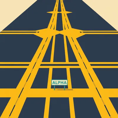
Welcome to My Weird Prompts. So Daniel sent us this one — he's been staring at FlightRadar24, watching all those little plane icons stacked over London and New York like digital sardines, and it hit him: the sky is supposed to be vast, infinite, three-dimensional. How does any of this work? How do you keep thousands of aircraft from turning into aluminum confetti, especially over cities? And what about over the Atlantic, where there's no radar at all? He's asking about wake turbulence too — is that still a real danger or just something pilots mutter about? It's a good set of questions. The sky looks empty from your window seat. It's not.
It's absolutely not. And I think that's the cognitive dissonance that gets everybody. You look out the window at cruise altitude and it's just blue void forever. But what you're not seeing is the invisible architecture — the walls, the floors, the one-way streets. FlightRadar24 is the closest thing we have to putting on glasses that reveal the matrix. What Daniel's seeing is the most intensively managed three-dimensional volume on the planet.
The musical equivalent of beige wallpaper — air traffic control. Nobody notices it until it stops working.
And when it stops working, you get a near-miss at San Francisco where an Air Canada plane almost lands on a taxiway with four fully loaded aircraft sitting on it. That was twenty-seventeen. The system caught it with seconds to spare. But the reason that story is remarkable is because it's so rare. The system works something like ninety-nine point nine-nine-something percent of the time. Let's frame this properly. The core problem is that airspace is a three-dimensional volume, but traffic is squeezed into these narrow corridors — jet routes, standard arrival paths, departure procedures. It's not a open field where everyone can spread out. It's more like a highway system with on-ramps and off-ramps and passing lanes, except the highways are invisible and they move twice a day over the Atlantic to chase the jet stream.
Where do we even start with this? The prompt is really asking three things. How does separation work over land with radar? How does it work over oceans without it? And where does wake turbulence fit into all of this?
Let's start where the problem is most intense: the airspace around a major airport. Picture a Boeing seven forty-seven lifting off from JFK. Behind it in the queue is a Cessna Citation, a business jet. How far apart do they need to be? The answer is not just a number — it's an entire system of rules that scales from that single runway all the way up to the North Atlantic tracks carrying fifteen hundred flights a day.
Okay, walk me through it. I'm the controller. I've got a seven forty-seven rotating off runway two-two left. What am I thinking?
You're thinking about three things simultaneously. Lateral separation, vertical separation, and wake turbulence. Let's take them in order. The fundamental separation minima in controlled airspace — and these are numbers burned into every controller's brain — are five nautical miles laterally and one thousand feet vertically below flight level two ninety, which is about twenty-nine thousand feet. Above that, it used to be two thousand feet vertical separation. But in the year two thousand, something called Reduced Vertical Separation Minima, or RVSM, was implemented globally. That brought the vertical minimum down to one thousand feet all the way up to flight level four-ten — roughly forty-one thousand feet. That single change increased airspace capacity by about eighty percent.
From just halving the vertical buffer?
From halving the vertical buffer in the upper flight levels, yes. Before RVSM, you essentially had half as many usable altitudes between twenty-nine thousand and forty-one thousand feet. Planes were stacked with two-thousand-foot gaps. Now they're stacked with one-thousand-foot gaps. Same physical sky, double the lanes. It was one of the quietest revolutions in aviation history. Airlines saved billions in fuel because they could now fly at more optimal altitudes instead of being stuck at whatever level was available.
The equipment to make that work — I assume you need altimeters that are absurdly precise?
RVSM requires aircraft to have two independent altimetry systems, an altitude alert system, and an autopilot that can hold altitude within about sixty-five feet of the assigned level. If your aircraft isn't RVSM-certified, you're stuck below twenty-nine thousand feet, burning more fuel. The technical tolerances are wild. You've got two planes passing each other with a thousand feet of vertical separation — that's about three football fields — at a combined closing speed of potentially a thousand miles an hour. The altimetry error budget is tiny.
That's vertical. What about lateral? Five nautical miles — that's what, about nine kilometers?
About nine point three kilometers. And that's the standard en-route minimum in radar-controlled airspace. But here's where it gets interesting. That five-nautical-mile minimum assumes the controller can see you. And they can see you because of radar — specifically, two kinds of radar working together. Primary radar is the old-school stuff. It sends out a radio pulse, it bounces off the aircraft's metal skin, and the return tells the controller "something is there, at this bearing, at this range." No cooperation from the aircraft required. Secondary radar is different — it sends out an interrogation signal, and the aircraft's transponder replies with information. "I'm flight BAW one-seven-two, I'm at thirty-five thousand feet, and here's my squawk code.
Squawk code — that's the four-digit number they assign you?
That's the one. And Mode S, which stands for Mode Select, goes further. It gives each aircraft a unique twenty-four-bit address and allows selective interrogation — the ground station can say "I want to talk to this specific aircraft, not everyone in the beam." Mode S is what makes a lot of modern tracking possible. And then on top of all that, since twenty twenty-five, the FAA has mandated ADS-B Out for all aircraft operating in most controlled airspace. ADS-B — Automatic Dependent Surveillance-Broadcast — is the real game-changer. The aircraft uses GPS to determine its own position, then broadcasts that position, along with altitude, velocity, and identification, once per second.
The aircraft is essentially snitching on itself, continuously.
In the most helpful way possible. And the precision is remarkable. ADS-B position data is typically accurate to within about ten meters. Compare that to radar, which might be accurate to within a few hundred meters at range, and the resolution improvement is enormous. But here's the thing — ADS-B is dependent surveillance. It relies on the aircraft's own systems being accurate. If the GPS fails or the transponder goes down, you lose the track. That's why primary radar isn't going anywhere — it's the independent backup that doesn't require the aircraft to cooperate. Redundancy is the religion of air traffic control.
Now I'm the controller again. I've got radar, I've got ADS-B, I've got transponders squawking. I'm looking at a screen full of targets converging on, say, Heathrow. How do I actually manage this? What does the layer cake look like?
The layer cake is the perfect metaphor. Around a major airport, you're in what's called Class B airspace — the busiest, most tightly controlled category. Picture an upside-down wedding cake, with the airport at the center. The airspace extends outward and upward in steps. Arrivals are descending through this volume from the top. Departures are climbing through it from the bottom. And in the middle, you might have overflights just passing through. The approach controller's job is to thread these needles — to sequence arrivals into a conga line while punching departures out through the gaps.
The tool for that is the holding pattern — the stack.
It's exactly what it sounds like. Aircraft are assigned to holding fixes — specific navigation points — and they orbit at assigned altitudes, separated vertically by a thousand feet. When the runway can accept another arrival, the controller clears the lowest aircraft out of the stack, and everyone else drops down a thousand feet. It's a vertical queue. Not elegant, but brutally effective. The classic example is the stacks over London — Bovingdon, Lambourne, Ockham, Biggin Hill. On a busy morning, you might have a dozen aircraft circling, waiting their turn. The pilot gets a time, not a distance. "Expect further clearance at zero-seven-two-three." And you just fly circles until then.
It sounds almost medieval. Aircraft burning fuel in circles while a human being manually sequences them like a maître d' at a restaurant.
Yet it works. The alternative is chaos. But let me add another layer to this — because we haven't talked about wake turbulence yet, and wake turbulence is the reason a lot of that sequencing exists in the first place. It's not just about keeping planes from bumping into each other. It's about the invisible tornado each plane leaves behind.
Alright, explain wake turbulence to me. I know it's a thing. I know small planes don't like flying behind big planes. But what's actually happening in the air?
When a wing generates lift, it creates a pressure differential — low pressure above, high pressure below. At the wingtips, the high-pressure air spills around to the low-pressure side, creating a pair of counter-rotating vortices — horizontal tornadoes, essentially — that trail behind the aircraft. These vortices are strongest when the aircraft is heavy, slow, and configured for landing or just after takeoff — exactly the moments when aircraft are closest together near airports. The vortices sink behind the aircraft, typically descending at about three hundred to five hundred feet per minute, and they drift with the wind. They can persist for several minutes before dissipating. A following aircraft that flies into one of these vortices can experience a sudden, violent roll — and we're talking roll rates that can exceed the pilot's ability to counter, especially at low altitude where there's no room to recover.
This isn't just a comfort issue. This is a "the plane might flip over" issue.
It's a structural and control issue. The most famous case is American Airlines flight five-eight-seven in two thousand one. An Airbus A300 took off from JFK behind a Japan Airlines seven forty-seven. The A300 encountered the seven forty-seven's wake vortex, and the first officer's aggressive rudder inputs to counter the roll — combined with the aerodynamic loads from the vortex itself — caused the vertical stabilizer to separate from the aircraft. The plane crashed in Queens. Two hundred sixty-five people died. That crash fundamentally changed how wake turbulence is taught and how separation is applied.
The separation rules are written in blood, as they say.
And that's why the categories exist. ICAO — the International Civil Aviation Organization — classifies aircraft into wake turbulence categories. Super, which is just the Airbus A380 and the Antonov An-225, though the An-225 was destroyed. Heavy — aircraft with a maximum takeoff weight above one hundred thirty-six metric tons. Medium — between seven and one hundred thirty-six tons. And Light — below seven tons. The separation minima between these categories depend on who's following whom.
What's the rule? If I'm a Heavy following a Super?
Six nautical miles. A Heavy behind a Super — say, a Boeing seven forty-seven behind an A380 — needs six nautical miles of separation on approach. That translates to roughly a two-minute gap. For context, without wake turbulence constraints, that gap might be three nautical miles — so you're doubling the spacing, which reduces the runway's arrival rate by about thirty percent. That's a massive throughput penalty at a busy airport.
The A380 is actually a capacity problem, not just a capacity solution.
And it's one of those knock-on effect nobody talks about when they're marveling at the size of the thing. Yes, it carries five hundred passengers. But it also forces everyone behind it to wait longer. The net effect on an airport's operations depends on the mix. If you're Frankfurt or Dubai, where A380s are common, you've built your scheduling around these separations. But throw an A380 into an airport that rarely sees them, and the ripple effects can cascade through the entire arrival sequence.
This is all still based on weight categories? Not actual vortex measurements?
That's where it gets interesting — and this is one of the quiet revolutions I love. In twenty twenty-three, ICAO implemented something called RECAT-EU — that's the European wake turbulence re-categorization. Instead of the old four-category system, RECAT-EU uses six categories and bases the separations on actual vortex behavior data rather than just weight. Researchers used LIDAR — laser radar — to measure how long vortices actually persist behind different aircraft types, how they decay, how they drift. And what they found was that some of the old separations were overly conservative. A Boeing seven eighty-seven, for example, produces weaker vortices than its weight would suggest, so aircraft following it can safely be closer. The re-categorization reduced some separation minima by up to one nautical mile, which doesn't sound like much but saves airlines millions in fuel and increases airport throughput without compromising safety.
The system is getting smarter. It's moving from blunt categories to measured behavior.
It's moving from "this plane weighs X, so stay Y miles back" to "this plane produces this specific vortex signature, which decays at this rate, so here's the actual safe distance." It's the difference between a tailor-made suit and something off the rack. And it's the kind of optimization that only becomes possible when you have the data. LIDAR installations at major European airports — Frankfurt, Heathrow, Paris Charles de Gaulle — have been quietly measuring vortex behavior for years, building the empirical case for these changes.
That's the land picture. Radar, ADS-B, stacks, wake turbulence categories — the whole apparatus of controlled airspace. But the prompt also asked about oceans. What happens when you're five hundred miles from the nearest radar antenna?
That's where the system shifts from surveillance-based to procedural. And the North Atlantic is the perfect case study — it's the busiest oceanic airspace on the planet. About fifteen hundred flights cross it every day. And for most of aviation history, once an aircraft flew beyond about two hundred nautical miles from shore, it disappeared from the controller's screen. The controller was working from position reports the pilots sent via HF radio — high frequency, crackly, often barely readable — every thirty to sixty minutes. "This is Speedbird one-seven-two, position five-three north, thirty west at one-three-four-five, flight level three-five-zero, estimating five-four north, twenty west at one-four-two-zero." The controller wrote that on a paper flight progress strip, calculated where the aircraft should be based on its reported speed and track, and kept that mental model updated until the next report came in.
For up to an hour, a plane could be anywhere within a pretty large uncertainty bubble, and the controller was just... trusting the math?
Trusting the math and building enormous safety margins into the system. That's why oceanic separation standards are so much larger than over land. Lateral separation over the North Atlantic was traditionally sixty nautical miles. Longitudinal — that's aircraft following each other on the same track — was ten minutes, which at typical cruise speeds is about eighty nautical miles. Compare that to the five nautical miles over land. You're talking about an order of magnitude difference. The ocean is big, but the usable airspace is artificially constrained by the imprecision of the tracking.
The Organized Track System — this is the thing where the routes change twice a day?
That's it. The North Atlantic Organized Track System, or OTS. Every day, twice a day, the air traffic control centers on both sides of the Atlantic — NATS in the UK, NAV CANADA in Canada — negotiate a set of tracks. These are like invisible highways across the ocean, and they're designed to take maximum advantage of the jet stream. Westbound tracks are published for the daytime hours, when traffic flows from Europe to North America. Eastbound tracks are published for the overnight hours, when traffic flows the other way. The tracks shift north or south depending on where the strongest tailwinds are. An eastbound flight wants to ride the jet stream — it can cut an hour off the crossing. A westbound flight wants to avoid it. The OTS is effectively a daily weather-optimized routing system, and every airline files preferred routes, and the tracks are negotiated to accommodate as many of those preferences as possible while maintaining safe separation.
The route from JFK to Heathrow isn't a fixed line on a map. It's different every single day.
Every single day. And it's not the great-circle route — the shortest distance between two points on a sphere. It's the fastest route given the winds. Those are often different things. A flight might fly two hundred miles further in distance but arrive thirty minutes earlier because it caught a hundred-knot tailwind. The OTS is fundamentally a time-optimization system disguised as a traffic management system.
The handoff between oceanic sectors — I've heard this is almost invisible to the pilot.
It's called a silent transfer. When a flight crosses from Gander Oceanic, which is the Canadian sector, to Shanwick Oceanic, which is the UK-Irish sector, the controllers coordinate via data link. The pilot doesn't change frequencies, doesn't make a position report, doesn't do anything. The transfer happens in the background. It's one of those pieces of invisible choreography that makes the whole system work. The pilot might not even know which oceanic center they're talking to at any given moment.
Like the handoff between cell towers. You don't notice it happening.
And that's the goal — make the infrastructure invisible. But let me get to the real revolution in oceanic airspace, because it's happened in just the last few years, and it changes everything we just talked about. In twenty nineteen, a company called Aireon launched a space-based ADS-B network. They put ADS-B receivers on the Iridium NEXT satellite constellation — sixty-six satellites in low Earth orbit. For the first time, controllers could see aircraft positions over the entire planet, updated every eight seconds, with no gaps.
Every eight seconds. Compared to every thirty to sixty minutes with HF radio.
It's not even the same category of capability. It's like going from a sundial to an atomic clock. And the operational impact was immediate. Starting in twenty twenty-two, the North Atlantic began reducing lateral separation on some tracks from sixty nautical miles to twenty-five nautical miles. That's a capacity increase of roughly thirty percent on those tracks. More aircraft can fly the optimal wind routes instead of being forced onto less efficient tracks because the prime tracks are full. Less fuel burn, less CO2, shorter flight times.
Why did it take until twenty nineteen to put ADS-B receivers on satellites? This feels like an obvious idea.
It's one of those ideas that's obvious in retrospect but required several things to converge. First, ADS-B had to be widely adopted on aircraft — and the mandates for that only really kicked in during the twenty-tens. Second, you needed a satellite constellation with global coverage and the right orbital characteristics. Iridium NEXT was a multi-billion-dollar project that replaced the original Iridium constellation. Third, you needed the signal processing to work — ADS-B was designed for ground stations, not space-based receivers hundreds of miles up, moving at seventeen thousand miles an hour. Aireon had to solve some genuinely hard engineering problems to make the receivers sensitive enough and the signal processing robust enough to track thousands of aircraft simultaneously from orbit.
Now it's just... Planes pinging satellites every eight seconds, anywhere on Earth.
Including the poles, by the way, which were previously even more of a black hole than the oceans. And this is enabling a shift that I think is underappreciated. Oceanic airspace is moving from procedural separation — "you are here because you said you were here ten minutes ago" — to surveillance-based separation — "I can see you right now, and I can see the aircraft ahead of you, and you are twenty-three point seven nautical miles apart." The controller's mental model is no longer based on estimates and strips. It's based on a real-time display that looks increasingly like the radar displays over land.
There's something almost philosophical here. The ocean used to be the place where you were truly alone, untracked, out of contact. And now that's been closed. Every flight is watched, everywhere, all the time.
The last empty space got filled in. And from a safety perspective, it's an unambiguous good. Before space-based ADS-B, an aircraft over the ocean could be lost for thirty minutes or more between position reports. If something went wrong — a depressurization, an engine failure, a hijacking — the world might not know until the next scheduled report. Now the controller sees the deviation in real time. The Malaysia Airlines three-seventy disappearance in twenty-fourteen — that was before this system existed. It's hard to imagine an aircraft simply vanishing today the way that one did.
The prompt also mentioned wake turbulence over oceans. Is that a factor in the OTS design?
It is, but it's less of a constraint than near airports because the separations are already so large. The OTS does group aircraft by wake turbulence category to some extent — you generally don't put a Super or Heavy on the same track directly ahead of a Light or Medium if you can avoid it. But the sixty-nautical-mile lateral separation — or even the newer twenty-five-nautical-mile separation — is so much larger than wake turbulence requires that it's usually a non-issue. The bigger constraint is the longitudinal separation on the same track. If you have a Heavy followed by a Light on the same oceanic track, you still need to ensure adequate time spacing, but the ten-minute longitudinal standard already exceeds what wake turbulence would demand.
The ocean is more about the procedural machinery of the tracks than about vortex avoidance.
And that procedural machinery is fascinating in its own right. The OTS is negotiated every twelve hours. Airlines submit their preferred routes to the track allocators. The allocators — one at Prestwick in Scotland, one at Gander in Newfoundland — work out a set of tracks that accommodate as many preferences as possible while maintaining the required separations. The tracks are published. Airlines then file their actual flight plans on those tracks. And then, in real time, the oceanic controllers manage the flow. If a track gets too crowded, they assign speed adjustments or altitude changes. The whole thing is a giant optimization problem solved by humans with computers assisting.
This is the system that carries something like fifteen hundred flights a day across the North Atlantic alone.
It's been doing it for decades with a safety record that is, statistically, nearly perfect. The last fatal mid-air collision over the North Atlantic was... I can't think of one. The procedural system, for all its apparent crudeness, worked.
Now it's being replaced by surveillance, which should be even safer.
Safer and more efficient. And this gets to a broader pattern in air traffic control that I think is the real story here. The system has always been about safety margins. You keep planes apart by some minimum distance, and that minimum distance is set by the precision of your tracking technology plus a buffer for human reaction time plus a buffer for the unexpected. As the tracking technology improves — from primary radar to secondary radar to ADS-B to space-based ADS-B — the minimum distance shrinks. But it never goes to zero. There's always a margin. The system is designed to be robust to single failures. If the radar fails, the controller still has ADS-B. If the ADS-B fails, the controller still has the procedural fallback. If everything fails, the pilot still has eyes out the window and TCAS — the Traffic Collision Avoidance System — in the cockpit.
TCAS — that's the thing that yells "climb" or "descend" at pilots?
That's it. TCAS is the last line of defense. It operates independently of air traffic control. The aircraft interrogate each other's transponders and calculate whether a collision threat exists. If it does, TCAS issues a Resolution Advisory — "climb, climb" or "descend, descend" — and the pilots are trained to follow it immediately, even if it contradicts what the controller is saying. TCAS is what prevented the Überlingen mid-air collision in two thousand two from being an even worse disaster — it worked on one of the two aircraft, but the other pilot followed the controller's instruction instead of the TCAS alert. After that crash, the rules changed: TCAS always takes priority.
The system has layers. Controller procedural separation, radar surveillance, ADS-B, TCAS, and ultimately the pilot's eyes. Defense in depth.
That's what makes it so robust. Any single layer can fail, and the others catch it. The San Francisco near-miss in twenty-seventeen that I mentioned earlier — the Air Canada plane lined up on the taxiway instead of the runway. Four aircraft were on that taxiway. The controller saw the error on the surface movement radar and ordered the go-around. One layer caught the failure of another. That's the system working as designed.
Which brings us to the passenger experience. What does all this mean for someone sitting in seat twenty-two-A, looking at the in-flight map?
A few things. First, over the ocean, notice that you're not flying a straight line. That's the OTS. You're on a track that was designed this morning to catch the best winds. Second, over land, notice the altitude changes — the step climbs and descents. That's ATC managing vertical separation, moving you through the layer cake. Third, if you're on approach to a busy airport and you feel the aircraft level off and start turning in circles — that's the stack. You're in the holding pattern, waiting your turn. And fourth, if you're behind a very large aircraft and you notice a longer-than-usual gap on final approach — that's wake turbulence separation. You're waiting for the vortices to dissipate.
It's funny. Most passengers probably experience these things as annoyances — the holding, the altitude changes, the indirect routing. But they're actually evidence of the system functioning.
Every delay, every deviation, every altitude change is someone making a decision to keep you safe. The system is invisible by design, but it leaves traces. Once you know what to look for, you see them everywhere.
Let's pull back for a moment. The prompt asked about three things — urban separation, oceanic separation, and wake turbulence. We've covered all three. But I want to push on something. The system works for a few thousand flights a day. What happens when urban air mobility takes off — eVTOLs, delivery drones, air taxis? The current system is built on controllers talking to pilots. You can't have a human controller managing a million drone flights over a city.
This is the frontier. And you're right — the current system doesn't scale to that. The answer is something called UTM — Unmanned Traffic Management — which is being developed in parallel with the existing ATC system. UTM is automated by design. Drones file flight plans digitally, the system deconflicts them algorithmically, and the drones fly the approved routes autonomously. Human oversight, but not human control of every vehicle. NASA has been leading a lot of this research. They've run trials at Dallas-Fort Worth with something called the ATD-two project — Airspace Technology Demonstration two — that uses machine learning to predict arrival times and optimize spacing. The idea is dynamic separation — separation minima that adjust in real time based on weather, traffic density, wake turbulence conditions, and aircraft performance.
Dynamic separation — so instead of fixed rules like "five nautical miles," the system might say "right now, with this wind and this traffic mix, three point two nautical miles is safe.
That's the vision. And it's a fundamental shift from rules-based to performance-based separation. The old system says "here is the rule, always." The new system says "here is the acceptable level of safety, and the separation can vary as long as that level is maintained." It's more efficient, but it requires a much deeper understanding of the physics — wake vortex behavior in different atmospheric conditions, aircraft performance envelopes, human factors in controller workload. All of that has to be modeled and validated.
The human controller's role shifts from tactical — "turn left, descend to three thousand" — to strategic — "the system is showing a conflict developing in sector seven, let me adjust the flow rates.
The controller becomes a manager of automation rather than a direct operator. It's the same transition that's happening in cockpits — pilots managing flight management systems rather than hand-flying. The automation handles the routine, the human handles the exceptions. And that's the model that will allow the system to scale.
The quiet revolution in oceanic airspace — space-based ADS-B enabling surveillance where there was none — is a preview of a broader shift. From procedural to surveillance-based, from fixed to dynamic, from human-executed to human-supervised.
It's happening incrementally, which is the only way it can happen in a safety-critical system. You don't rip out the old system and install the new one over a weekend. You introduce new capabilities, validate them, reduce separation minima gradually, monitor the results, and then take the next step. The reduction from sixty nautical miles to twenty-five over the North Atlantic didn't happen overnight — it happened after years of data collection showing that space-based ADS-B was reliable enough to support it.
That incrementalism is probably why the system is as safe as it is. Nobody's moving fast and breaking things in air traffic control.
Nor should they. The cost of failure is measured in lives. And yet the system does evolve. The RVSM implementation in two thousand, the RECAT-EU re-categorization in twenty twenty-three, the space-based ADS-B rollout — these are all significant changes that were implemented without disrupting operations. Aviation is remarkably good at this particular thing: introducing new technology into a live, safety-critical system without breaking anything.
Because the alternative is unthinkable. The system works, and it works so well that it's invisible. The sky looks empty. But it's not empty — it's just very, very well organized.
Now: Hilbert's daily fun fact.
Hilbert: In the seventeen-twenties, Roman provincial road maintenance was funded by a mandatory labor tax called the corvée, which required local inhabitants to provide several days of unpaid work per year. If the same system applied to Tuvalu's twenty-six square kilometers of land area, each of its roughly eleven thousand residents would be responsible for maintaining approximately twenty-four hundred square meters of road — about a third of a football pitch — per work day, assuming a standard five-day corvée obligation.
...right.
Here's the open question. We're standing at the edge of a transformation in how airspace is managed. Space-based surveillance has closed the last gaps. Dynamic separation is being trialed. Drones and eVTOLs are coming. The system that was built for a few thousand flights a day is being asked to handle millions. The principles that got us here — layered redundancy, incremental change, safety margins that shrink but never disappear — will those be enough? Or will the volume of traffic demand a fundamentally different approach?
The sky isn't empty. It's just very, very well organized. And the organization is about to get a lot more complex.
This has been My Weird Prompts. Thanks to our producer, Hilbert Flumingtop, and to everyone who sent in prompts this week. You can find us at myweirdprompts dot com, and if you've got a question you want us to dissect, send it in. We read everything.
Until next time.

")