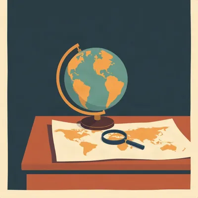
So Daniel's question lands on a map that's been quietly lying to everyone for four and a half centuries. He's asking about the UN's vote today to adopt the Correct the Map resolution, the one that nudges the world away from Mercator and toward equal-area projections like the 2018 Equal Earth design. He wants to know how dramatic the size difference actually is between Africa and Europe on the standard map, why Togo framed Mercator as a colonial instrument rather than an innocent cartographic choice, what the resolution actually does, and why any of this turned controversial.

And the short answer to that last part is that the United States voted alone against it. One hundred sixty-four in favor, one against, six abstentions. If you'd told me a decade ago that a map projection would produce a one hundred sixty-four to one vote at the General Assembly, I'd have assumed the world had run out of actual problems.
The world hasn't run out of problems. It's just found a new way to argue about them using four-hundred-year-old geometry.
The vote happened this morning. Togo sponsored it on behalf of the African Group. The resolution encourages governments, schools, and tech companies to use equal-area projections when relative size matters, and it explicitly preserves Mercator for maritime and aerial navigation, where it remains useful. It's non-binding. Nobody's being forced to do anything.
Which is precisely why the American response is so strange. You don't call a non-binding suggestion a barnacle on the institution unless you're worried about something deeper than a classroom wall map.
The deputy US representative, Yaryna Ferencevych, said resolutions like this are barnacles on the UN's work and part of a radical ideological project. That's a lot of rhetorical firepower aimed at a projection that was designed in fifteen sixty-nine to help Dutch sailors not run into rocks.
And France announced it was abandoning Mercator hours before the vote. The French foreign minister called it an act of truth. So you've got the former colonial power in Africa co-sponsoring the thing, and the United States standing alone in opposition. The expected dynamic is completely inverted.
To understand why anyone cares this much, we have to start with what Mercator actually does to the world. Gerardus Mercator was a Flemish cartographer, and his fifteen sixty-nine projection solved a real and specific problem. On a globe, if you want to sail from Lisbon to the Caribbean along a constant compass bearing, your course traces a spiral. On Mercator's map, that same course is a straight line. You draw a line, measure the angle against the meridian, and that's your bearing. It's an extraordinary navigational tool.
And the cost of that convenience is that the map inflates everything as you move away from the equator. Mercator preserves local angles and shapes, but area goes completely out the window. The poles are infinitely far away, which is why you never see Mercator maps that include Antarctica in full.
The classic example is Greenland versus Africa. Africa is about fourteen times larger than Greenland. Fourteen times. But on a standard Mercator map, they look roughly the same size. You can fit the United States, China, India, and most of Europe inside Africa, and still have room left over. Mercator makes that fact invisible.
And it's not just Greenland. Northern Europe, Russia, Canada, the United States, all of them get magnified. The French foreign minister made the point that the US, Russia, and China take on disproportionate visual prominence compared to Africa, Latin America, or southeast Asia. The map doesn't just distort area, it distorts perceived importance.
The Equal Earth projection, developed in twenty eighteen by Tom Patterson, Bojan Šavrič, and Bernhard Jenny, takes a different approach. It's an equal-area pseudocylindrical projection, which means it preserves relative area while keeping a shape that looks familiar to anyone who grew up with a Robinson projection. It's designed to be pleasing to the eye, not just mathematically honest.
And here's the misconception that keeps tripping people up. Equal Earth doesn't make Africa look bigger than it actually is. It removes the exaggeration Mercator gives to polar landmasses. Africa's size on Equal Earth is accurate. Mercator was the distortion. The correction just looks dramatic because we've been staring at the wrong version for so long.
There are over two hundred major world map projections. Each one warps the sphere differently. Some preserve area, some preserve shape, some preserve distance, some preserve direction. No flat map can do all of them at once. It's mathematically impossible. So every projection is a choice about which distortion to accept.
Which is where the neutrality myth falls apart. People assume the map on the classroom wall is just the map, the default, the way the world looks. But someone chose it. And that someone was working within a particular set of priorities, often navigational or military or commercial.
The Boston Public Schools tried to switch away from Mercator in twenty seventeen, and the backlash was immediate. Cartographers complained that the replacement, the Gall-Peters projection, was ugly and distorted shapes badly. Parents complained that the new map looked wrong. Kids who'd grown up with Mercator had their mental image of the world solidified by age ten or eleven, and the new map didn't match.
So even a well-intentioned correction runs into the fact that people's sense of geography is emotional, not mathematical. You're not just changing a diagram, you're telling people their mental picture of the planet was wrong.
And that's before we get to the politics. Togo's foreign minister, Robert Dussey, has been explicit about the colonial framing. He said a map is never neutral, that it shapes perceptions and influences how the place of peoples and continents in the world is understood. The resolution itself describes correcting the distortions as an act of cognitive justice and memorial reparation.
Cognitive justice. It's not just about accuracy, it's about who gets to define the frame through which the world is seen. And the colonial history is real. Cartography was a tool of control during the European conquest of Africa. Surveyors and topographers accompanied military expeditions. Maps weren't just documenting territory, they were defining it in ways that served the colonizer.
The Berlin Conference of eighteen eighty-five is the starkest example. European powers sat down and partitioned Africa with zero African representation. They drew borders on maps that ignored ethnic, linguistic, and political realities on the ground. Those borders became the modern nation-states of Africa, with all the conflict that followed. Cartographers call it one of the pinnacles of the cartographic and colonial grab.
So when Dussey says the Mercator map's widespread use is a consequence of colonization, he's not being hyperbolic. The map was designed for European maritime expansion. Its distortions flatter the northern hemisphere, where the colonizing powers sat. And it became the default because those same powers controlled the institutions that printed and distributed maps.
The campaign itself is young. A twenty-eight-year-old Nigerian activist named Ogundairo leads the Correct the Map campaign. It had over four and a half thousand signatures on a Change.org petition as of last August. That's not a mass movement by global standards, but it got the African Union's attention. The African Union's fifty-four member states adopted Equal Earth in February, and then asked Togo to carry it to the UN.
Four and a half thousand signatures leading to a UN General Assembly resolution. That's an extraordinary amplification. It suggests the idea found receptive ground because the underlying grievance was already there, waiting for a vehicle.
And then there's the Ukraine abstention, which is the detail that complicates the whole thing. Ukraine didn't vote against the resolution, but it abstained because some Equal Earth maps depict Ukrainian territory occupied by Russia. Endorsing the projection without safeguards could open what they called a Pandora's box over disputed territories.
That's the knock-on effect nobody saw coming. A map projection designed to correct area distortion becomes entangled in territorial sovereignty disputes. The EU, through Ireland, had to stress that the measure applies only to relative size and has no bearing on borders. But the fact that they had to say it shows how loaded any cartographic choice can be.
The US position is fascinating in its own right. The deputy representative called the resolution part of a much larger and more radical ideological project. The US argued it mocks the work and purpose of the institution. For a non-binding resolution that explicitly preserves Mercator for navigation, that's a remarkable level of hostility.
What the US seems to be reacting to is not the map itself, but the framing. The resolution describes Mercator's distortions as an act of symbolic minimization tied to colonial history. Accepting that framing means accepting a particular account of how the world was ordered, and who benefited. That's a bigger concession than changing a classroom poster.
France's move is the counterpoint. Jean-Noël Barrot said distortions eventually take root in perceptions, and correcting a distorting representation is already an act of truth. France is a former colonial power in Africa. It has every reason to be defensive about this history. Instead, it co-sponsored and got out ahead of the vote.
Which inverts the expected dynamic completely. The former colonizer embraces the correction, and the country that likes to think of itself as the leader of the free world stands alone in opposition. It's a strange look.
The resolution itself is carefully worded. It doesn't ban Mercator. It doesn't phase it out. It encourages the use of equal-area projections when relative size matters, and it explicitly preserves Mercator for maritime and aerial navigation, for which it remains fully suited. Togo aims to put Equal Earth in its schools by the end of the year.
So the practical effect is limited, at least in the short term. But the signal is significant. The international community, by an overwhelming margin, has said that the default map of the world should not be one that systematically minimizes the global south. That's a shift in how institutions think about representation.
And the question is whether tech companies follow. Google Maps and Apple Maps don't use a single global projection for everything, they use Web Mercator for their web tiles. It's the standard for online mapping because it's computationally simple and works well at street level. Switching that would be a massive engineering effort.
But the resolution doesn't ask them to switch the underlying tiles. It asks them to consider equal-area projections when relative size matters, like in educational contexts or when showing the whole world. That's a much smaller ask, and one that's easier to ignore.
Which is the tension at the heart of this. The resolution is non-binding, so it can be ignored. But it's also a normative statement, and normative statements have a way of accumulating weight over time. The Boston Public Schools switch was controversial in twenty seventeen. By twenty twenty-six, the African Union has adopted Equal Earth and the UN has voted one hundred sixty-four to one. The Overton window on map projections has shifted.
Daniel's prompt framed it as the UN committing itself to phasing out Mercator, and I want to correct that slightly. The resolution doesn't phase anything out. It's an encouragement, not a mandate. Mercator stays for navigation. What changes is the default assumption that Mercator is the right choice for every context.
That distinction matters because it's the difference between a symbolic gesture and an actual policy change. The resolution is mostly symbolic. But symbols are how institutions signal their values, and this symbol is pointed at a very old wound.
And the wound is not just about maps. It's about who gets to define the terms of global representation. If Africa's size was wrong on the most widely used map in the world for four hundred and fifty years, what else about Africa has been accepted without questioning? That's the question Moky Makura from Africa No Filter asked. Africa doesn't need to be made bigger, she said. It needs to be seen accurately.
The map is not the territory, but it shapes how we imagine the territory. If you grow up seeing Africa as roughly the same size as Greenland, your sense of the continent's scale, its capacity, its importance, is subtly skewed. You don't notice it consciously, but it's there.
And if you grow up seeing Europe and North America as larger than they are, you absorb a sense of their centrality that isn't justified by geography. The map becomes a self-fulfilling argument for importance.
Let me pull in the technical detail that makes this concrete. Mercator's projection is a cylindrical projection. Imagine wrapping a cylinder around the globe at the equator. Project the globe's surface onto the cylinder, then unroll it. At the equator, the map is accurate. As you move toward the poles, the cylinder is farther from the globe's surface, so everything gets stretched. At the poles themselves, the stretch is infinite. That's why Mercator maps cut off before the poles.
And the reason sailors loved it is that the stretch is the same in all directions at any given point. So local shapes are preserved. A small island looks like a small island, just bigger or smaller depending on latitude. That's what made it useful for navigation.
Equal Earth, by contrast, is a pseudocylindrical projection. The central meridian is straight, but the other meridians curve. The area is preserved by compressing the map vertically as you move away from the equator, compensating for the horizontal stretch. The result is a map that looks a bit like the Robinson projection, but with accurate area.
The Robinson projection, for what it's worth, was the National Geographic standard for decades. It's not equal-area, but it's a compromise that looks balanced. Equal Earth was designed to look like Robinson while fixing its area distortion. That's why it's gained traction so quickly.
Tom Patterson, one of the Equal Earth creators, posted that when they designed it in twenty eighteen, they never imagined this. A UN resolution. That's a cartographer's wildest dream, or maybe their strangest nightmare.
The other thing worth noting is that the resolution doesn't mandate Equal Earth specifically. It points to Equal Earth as an example of an equal-area projection that works well, but it leaves room for other choices. The point is the principle, not the specific design.
Which is smart, because cartographers are a contentious bunch. If the UN had mandated a single projection, there would be a civil war within the cartographic community. By keeping it at the level of principle, they avoid the aesthetic debates and focus on the substantive issue.
The substantive issue being that area distortion has political consequences. When the map makes the global north look bigger than it is, it reinforces a particular mental model of the world. Correcting the area is a way of correcting the mental model.
And the mental model is sticky. The Boston Public Schools experience showed that even people who understand the math can feel disoriented by a new map. It's like changing the default font on a document you've read your whole life. The words are the same, but it feels wrong.
That's the inertia problem. Maps are infrastructure. They're embedded in textbooks, atlases, news graphics, weather reports, airline route maps, and the back of every classroom door. Changing the infrastructure means re-educating everyone who uses it.
The cost of re-education is real. The Boston schools faced backlash from parents who didn't understand why the map looked different. Teachers had to explain the projection. It took time and energy that could have gone elsewhere. The resolution doesn't solve that problem, it just signals that the problem is worth solving.
The Ukraine abstention is the detail that keeps nagging at me. A projection designed to correct area distortion ends up entangled in a territorial dispute. It shows that no cartographic choice is ever purely technical. Every map is a claim about the world, and some claims are contested.
The Irish EU statement had to walk a very careful line. They said the measure applies only to relative size and has no bearing on sovereignty or borders. But the fact that Ukraine felt the need to abstain shows that the concern isn't abstract. Maps get used in territorial arguments. A projection that changes how occupied territory appears could be weaponized.
Even a map designed to be more honest can be used dishonestly. That's not an argument against the resolution, but it's a reminder that the politics of representation never goes away.
The US position, to be fair to it, has a coherent core. The argument is that the UN should focus on substantive issues, not symbolic gestures. There's a real critique of the UN as a body that passes resolutions with no enforcement mechanism, generating paperwork instead of action.
But calling this a radical ideological project is a stretch. The resolution is modest. It encourages, it doesn't mandate. It preserves Mercator where Mercator works. The radicalism is in the framing, not the content.
The framing is the point. The resolution says Mercator's distortions are not just a mathematical quirk, they're a legacy of colonial power. That's the claim the US is rejecting. Not the map, but the history.
Which is why this is about more than cartography. It's about whether the international community is willing to name the colonial legacy as a live issue, not just a historical footnote. The map is a proxy for a much larger argument about historical responsibility and representation.
The argument is happening in a very concrete way. Togo wants Equal Earth in its schools by the end of the year. The African Union has already adopted it. France is abandoning Mercator. The question is whether this becomes a cascade or a one-off symbolic victory.
If tech companies shift their default world maps, that's the real inflection point. A billion people see a world map on their phone every day. If that map changes, the mental model changes at scale.
Google Maps and Apple Maps use Web Mercator for their web tiles. It's the standard for online mapping because it works well at street level and the math is simple. Switching to an equal-area projection for the whole world view would be a significant engineering effort, and it would break a lot of existing code.
But they could add an equal-area option for the globe view without changing the street-level tiles. That's a smaller lift, and it would satisfy the resolution's encouragement without disrupting the existing infrastructure.
The question is whether they will. Companies respond to user demand, and user demand for a different map projection is probably not at the top of anyone's list. But if enough institutions shift, the companies will follow.
That's the long game. The resolution is a signal, not a mandate. It creates a permission structure for institutions that want to change but were waiting for cover. Now they have it.

The USSR had to look big.
Say that again.
I worked as a temp cartographer for a British atlas publisher in the late eighties. Hand-coloring maps. The office manager insisted the Soviet Union had to look big. It was a superpower, he said. It had to look like one. So we used Mercator, and the USSR stretched across the top of the map like a red banner. Nobody thought about whether it was accurate. It just looked right.
That's the thing. The projection was supposedly neutral, but the choice to use it was driven by a sense of how the world should look.
The company went bankrupt in nineteen ninety-two. They had thousands of unsold Mercator maps of a world that no longer existed. The Soviet Union was gone, but the maps still showed it. They tried to fix it by hand-painting over the USSR with the new country borders. Kept the Mercator projection, though. Re-printing was too expensive.
They corrected the borders but kept the size distortion.
We fixed the borders but kept the lie about the size. It's cheaper to lie in the same shape.
That's the bureaucratic inertia in a nutshell. The cost of change is real, and the incentive to change is diffuse. Nobody got fired for keeping Mercator.
The office manager said the same thing about the hand-painting. He said nobody would notice the size was wrong, but everyone would notice if the borders were wrong. So we fixed what people would notice.
That's the whole story of why this resolution exists. The distortion was invisible because everyone had agreed not to see it. The correction is visible, and that's why it's controversial.
The maps sat in a warehouse for two years. Eventually they got pulped. I kept one. It's in a box somewhere.
A Mercator map with hand-painted post-Soviet borders. That's a document of a very specific moment.
It's a map of a world that never existed. Drawn to make a country look bigger than it was, then corrected with a paintbrush when the country disappeared. The projection stayed the same.
The projection always stays the same. That's the point.
I don't know much about the Equal Earth thing. But I know the old maps weren't neutral. They were made to look a certain way, and the way they looked mattered to the people who made them.
That's exactly what Togo is saying. The map was never neutral. It was a choice, and the choice had consequences.
The office manager would have hated this resolution. He'd have called it politics interfering with cartography. As if cartography wasn't already politics.
The map is not the territory, but it shapes how we imagine the territory. If the US is the sole dissenter, what does that say about its relationship to global institutions and historical revisionism?
It says the US is willing to stand alone on symbolic issues, even when the practical stakes are minimal. That's a choice about how to engage with the international system, and it has costs.
The open question is whether the resolution cascades. Togo will have Equal Earth in its schools by the end of the year. The African Union is on board. France is on board. Will other nations follow? Will the tech companies shift their defaults?
The deeper question is whether changing the map changes the perception. The resolution assumes it does. The Boston experience suggests it's slow and painful. But slow and painful is how mental models change.
The map is a claim about the world. Change the claim, and you change the argument. That's what this is really about.
Thanks to Hilbert Flumingtop for producing. This has been My Weird Prompts. Email us at show at my weird prompts dot com.
We'll be back soon.